Join us at our 2nd Annual Blizzard Ball

Forecast for the Uintas Area Mountains

Craig Gordon
Issued by Craig Gordon on
Wednesday morning, January 22, 2025
Expect MODERATE avalanche danger on steep, wind-drifted, mid and upper-elevation terrain facing north, through east, including southeast. Human triggered avalanches are POSSIBLE and remember... any slide initiated may fail on weak, sugary, faceted snow, delivering a deeper and wider slide than we might've bargained for.
Out of the wind-zone, LOW avalanche danger exists on all other aspects and elevations and is met with solid coverage and stellar riding conditions, particularly in wind sheltered, shady terrain with no overhead hazard.
Low
Moderate
Considerable
High
Extreme
Learn how to read the forecast here
Special Announcements
Huge thanks to everyone who took time out of their busy lives to join me for last nights, State of the Snowpack prezo... a completely packed, SRO show hosted by Alpha Coffee. It was so nice to see old friends and familiar faces, but also to put new names to new faces, all while spreading the avalanche gospel and having an absolute blast with our backcountry family! Y'all rock and I look forward to our paths, not our tracks, crossing soon :)
  • Please join the UAC at Deer Valley on January 30th for the 2nd Annual Blizzard Ball Gala. The night will be full of fun including delicious cuisine, live music, an auction, and presentation by Bruce Tremper. More info found here.
Weather and Snow
Nowcast- Dang... those winds. Blowing in the mid 30's, gusting to 70 mph and generally out of the west, with a little north and south thrown in to keep us honest... they're blasting the ridges and ushering in a dry, cold front. As if our cup hasn't already runnith over from an abundance of cold fronts lately. High clouds drift through the region at o'dark thirty and temperatures register in the single digits and low teens. Windchill clocking in at -25 degrees is a real thing near the high peaks. Our big open bowls are taking a hard hit from the wind, so steer your snow vehicle towards wind sheltered, mid and low elevation terrain and you'll be met with a go-anywhere base and a soft, creamy topper for your riding pleasure.
Forecast- Expect mostly sunny skies with temperatures climbing into the upper teens and low 20's. West and northwest winds blowing in the 40's, put a buzz-kill on the early morning, but should be decreasing after sunrise.
Futurecast- Not much going on in the weather department until late Friday when there's a suggestion for some storminess. The jury is still deliberating and we'll get you the latest deets as they develop.
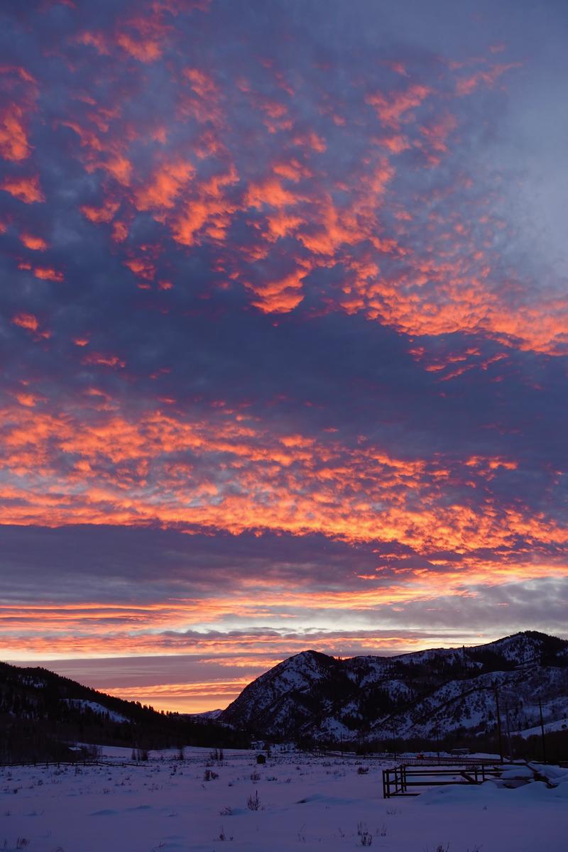
I know you came for the wind, but I hope you'll stay for the sunsets. Thanks to you Trevor, for sharing the warmth of your spirit, fully espoused in this colorful image :)
Recent Avalanches
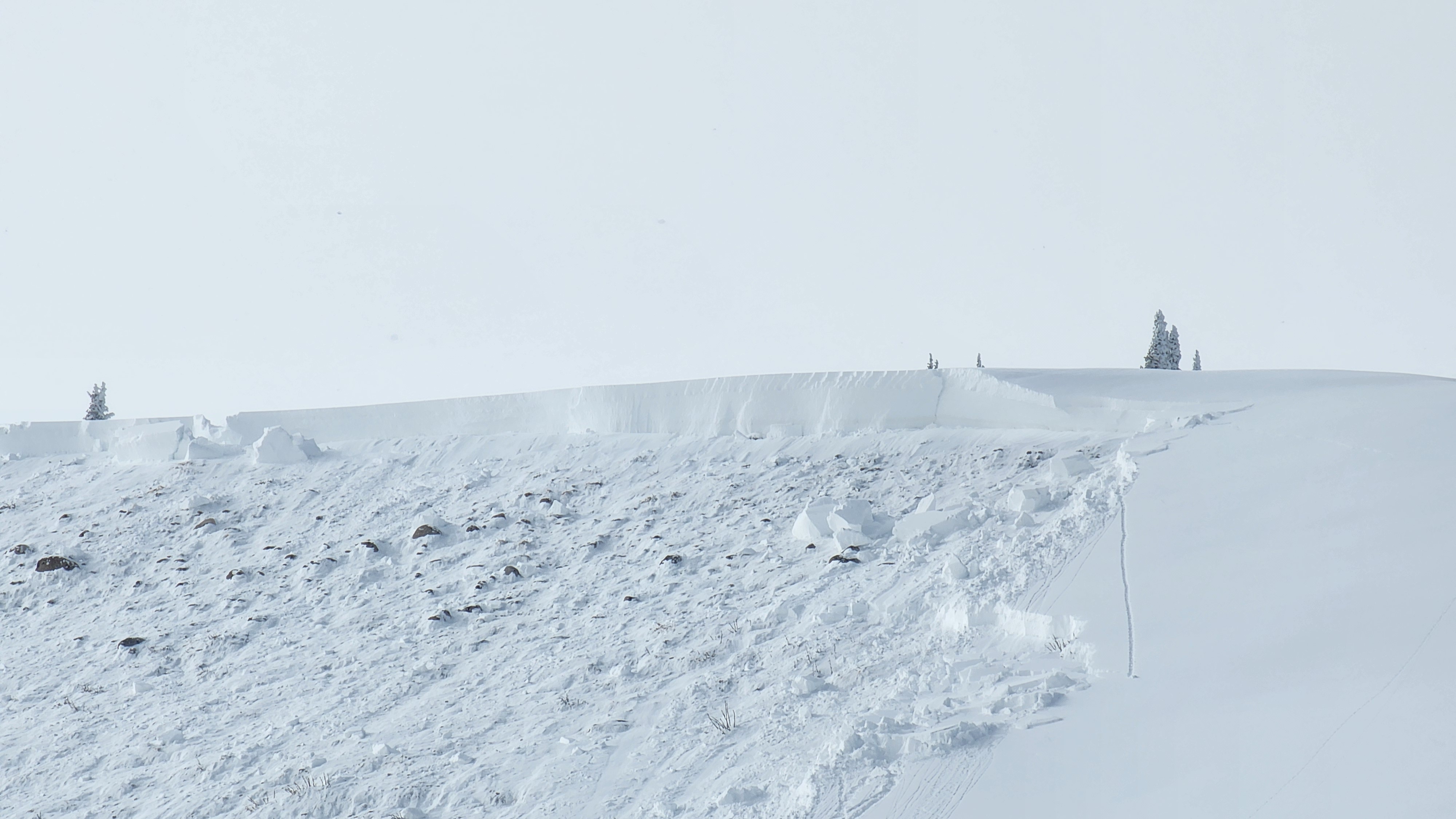
No new avalanches from the eastern front since January 19th, which you can see in the image above (full ob found here). Certainly a manageable avalanche dragon unless it knocks us off our ride, sending me spiraling into consequential terrain like cliffs, terrain traps, or trees. You can find trip reports and recent slides from across the range and beyond, here.
Ad
Avalanche Problem #1
Persistent Weak Layer
Type
Location
Likelihood
Size
Description
The last reported avalanche failing on our now mostly dormant problem child, the Persistent Weak Layer (PWL) formed during the December drought, was over a week ago on Sunday, January 12th. Good news is the snowpack has slowly gotten comfortable in its own skin. The tricky part is... while the likelihood of triggering a nasty persistent slab avalanche has gone down significantly over the past few weeks, the consequences remain severe if we do.
How do we manage the unmanageable? All the snow-pros I knows are avoiding the usual suspect slopes... steep, rocky, mid and upper elevation terrain, especially where the pack is slightly thinner. And remember... thin spots are potential trigger points and exist near bushes, rocks, or steep rollovers.
Avalanche Problem #2
Wind Drifted Snow
Type
Location
Likelihood
Size
Description
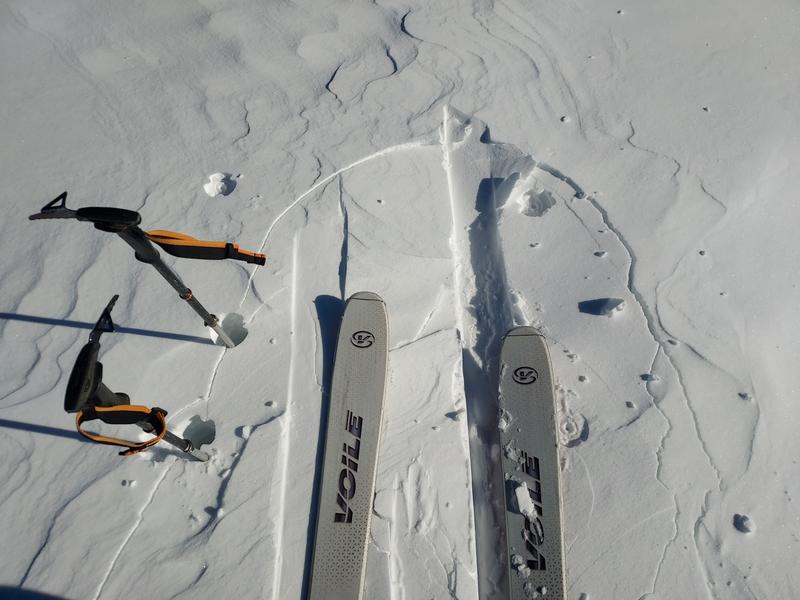
Following this visual cue, cracking around his skis, Micheal J traveled safely yesterday, steering clear of steep, wind drifted terrain and scored a great day of riding to boot... well played man!
Winds have blown for days, whipping up several batches of dense, hard slabs on mid and upper elevation leeward slopes. Unfortunately, today's drifts will feel solid under our skis, board, or sled and allow us to get well out on slope before breaking above or below us and have the potential to step down into deeper layers of the snowpack.
Today's drifts are a manageable and straight-forward avalanche problem with proper terrain choices and travel techniques. Choose clean slope run outs with less consequences like cliffs, rocks, or terrain traps and travel mindfully by exposing only one person at a time to the potential hazard.
General Announcements
The Uinta weather station network was upgraded this summer and all that real-time info is found here. Simply click on the "Western Uinta" tab and then the "Weather Stations" tab to find all your weather needs.
We are always looking for snow and avalanche observations or just general riding conditions. So... if you see something, say something. You can reach our team directly by contacting: Craig at craig@utahavalanchecenter.org, 801-231-2170, or Andrew at andy@utahavalanchecenter.org, or 860-460-8142.
General Information
This forecast is from the U.S.D.A. Forest Service, which is solely responsible for its content. This forecast describes general avalanche conditions and local variations always occur. This forecast was issued on Wednesday, January 22nd at 04:00AM and expires 24 hours after it was issued. We will update the forecast by 0700 AM tomorrow. But, in the meantime reach out to us with questions, or if you see anything in your travels.