Join us at our 2nd Annual Blizzard Ball

Forecast for the Uintas Area Mountains

Craig Gordon
Issued by Craig Gordon on
Tuesday morning, January 28, 2025
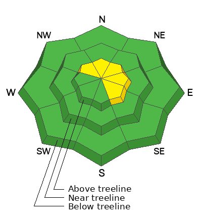
In the wind zone at and above treeline, MODERATE avalanche danger exists on steep, leeward slopes facing the north half of the compass, where it is still POSSIBLE to trigger an old, hard, stiff wind-drift. Although UNLIKELY and becoming more the exception than the rule, once initiated, today's avalanches could fail deeper into old, sugary facets now buried 1'-3’ beneath the snow surface, and that would deliver a body-bruising slide breaking deeper and wider than we might expect.
All other aspects and elevations offer LOW avalanche danger. Riding conditions are fantastic on many aspects in wind sheltered terrain, especially on low angle slopes where you won't feel rock hard wind-board or old, rutted tracks underfoot.
Low
Moderate
Considerable
High
Extreme
Learn how to read the forecast here
Special Announcements
  • Urgent battery replacement required for anyone who received batteries from one of our participating "Batteries for Beacons" shops. Please review the "Batteries for Beacons" replacement notice on our blog. Batteries distributed through our "Batteries for Beacons" program this year have shown to be inadequate length.
  • Please join the UAC at Deer Valley on January 30th for the 2nd Annual Blizzard Ball Gala. The night will be full of fun including delicious cuisine, live music, an auction, and presentation by Bruce Tremper. More info found here.
Weather and Snow
Nowcast- High pressure settles in over the region, delivering severe clear skies, temperatures in the teens and light northeasterly winds blowing just 10-20 mph. near the high peaks.
Forecast- A beautiful day is on tap with sunny skies, easterly winds blowing in the teens, and temperatures rising into the 30's. Overnight lows dip into the upper teens.
Futurecast- Rinse and repeat weather for the next few days, though there's a hint of change as we wrap up the workweek. And while there's still much uncertainty, it looks like a warm, moist pattern rolling into the weekend. Stay tuned... we'll update you with the deets throughout the week.
Recent Avalanches
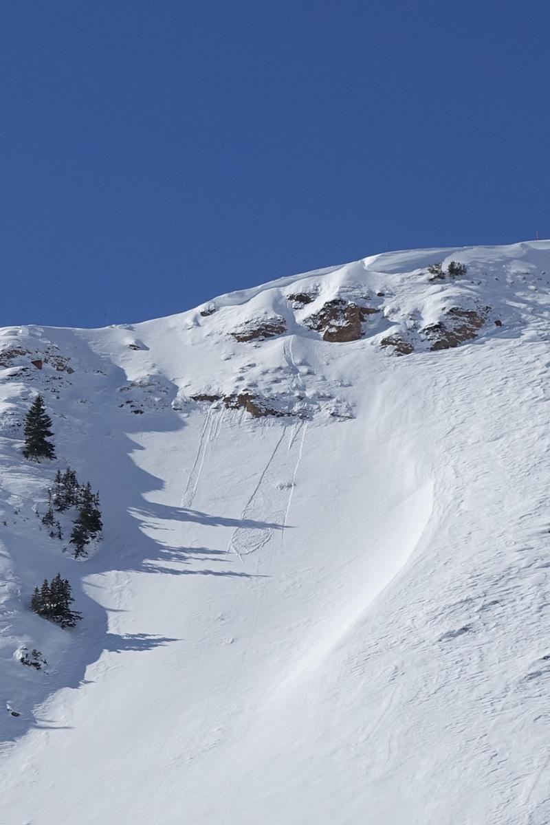
Thanks to Trevor Katz for sharing this image of a small avalanche on a sustained steep slope from his travels in Upper Weber Canyon yesterday. TK's observation illustrates the weakening snow surface... not particularly a threat at the moment, rather something to keep an eye on with potential storminess materializing later this week.
Check out more obs and trip reports from across the range and beyond, here!
Ad
Avalanche Problem #1
Wind Drifted Snow
Type
Location
Likelihood
Size
Description
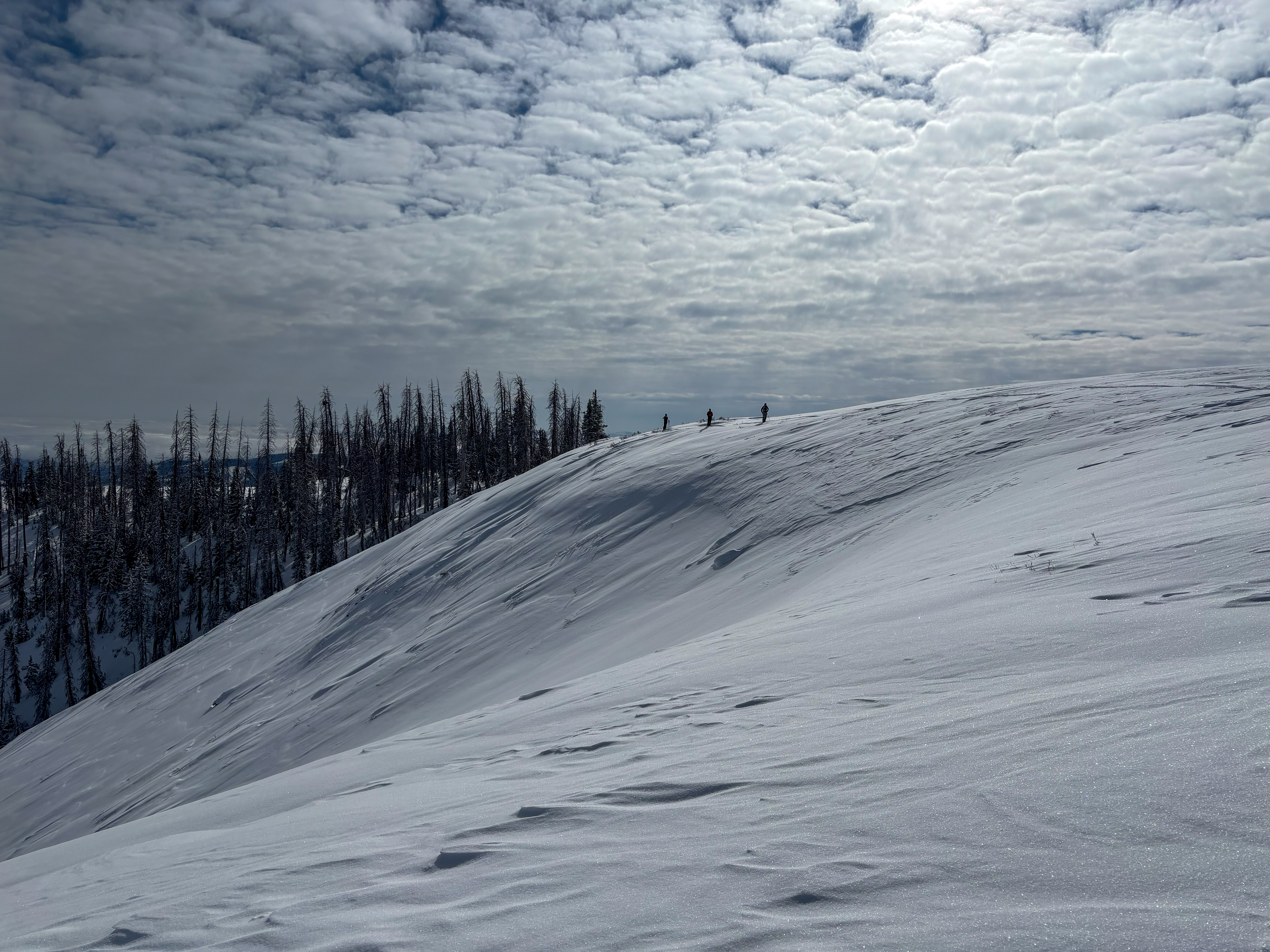
Last weeks winds were all over the compass, creating stiff, hard, wind drifts on the leeward side of upper elevation ridges and around terrain features like chutes and gullies. A couple inches of weekend snow helps camouflage drifted terrain and adds a little complexity to the overall picture. My strategy for today is starting off with some mini golf terrain with little consequence to get a feel for the personality of the avalanche dragon I wanna avoid. I'm steering clear of fat looking rounded pillows of snow, especially if they feel hollow or sound like a drum.
Now here's where the rubber hits the road-
With proper terrain choices and travel techniques, today's drifts are mostly manageable and straight-forward. Look for clean slopes void of cliffs, rocks, or terrain traps and travel with intent by exposing only one person at a time to the potential hazard. Remember, even a small slide can knock you off your feet and let you know who's the boss in consequential terrain. Bordering on terrain we often refer to as the wind zone, above is an upper elevation, north facing slope. You can see by the snow texture, this is a heavily wind drifted, leeward slope... exactly the type of terrain we wanna avoid today.
Avalanche Problem #2
Persistent Weak Layer
Type
Location
Likelihood
Size
Description
Persistent weak layer (PWL)... it's in the name, the avalanche encyclopedia, and now a very well written and informative BLOG.
Good news is... the mid December drought layer that is our PWL appears largely dormant. In fact, we haven't seen an avalanche fail to this layer in over two weeks and our stability tests along with pit results are trending nonreactive... in other words, in the right direction. And while that's encouraging, I bet if you're of the hunter-gatherer mindset you could potentially bag a rogue pocket that breaks to older snow in steep, rocky terrain. Now here's the tricky part of the song... the likelihood of triggering has decreased significantly, but the consequences remain severe.
How do you manage an unruly avalanche dragon? I keep it straight forward and tight. I'm avoiding steep, rocky, mid and upper elevation terrain on the north half of the compass, especially where the pack is slightly thinner. And I remind myself... thin spots are potential trigger points and exist near bushes, rocks, or steep rollovers.
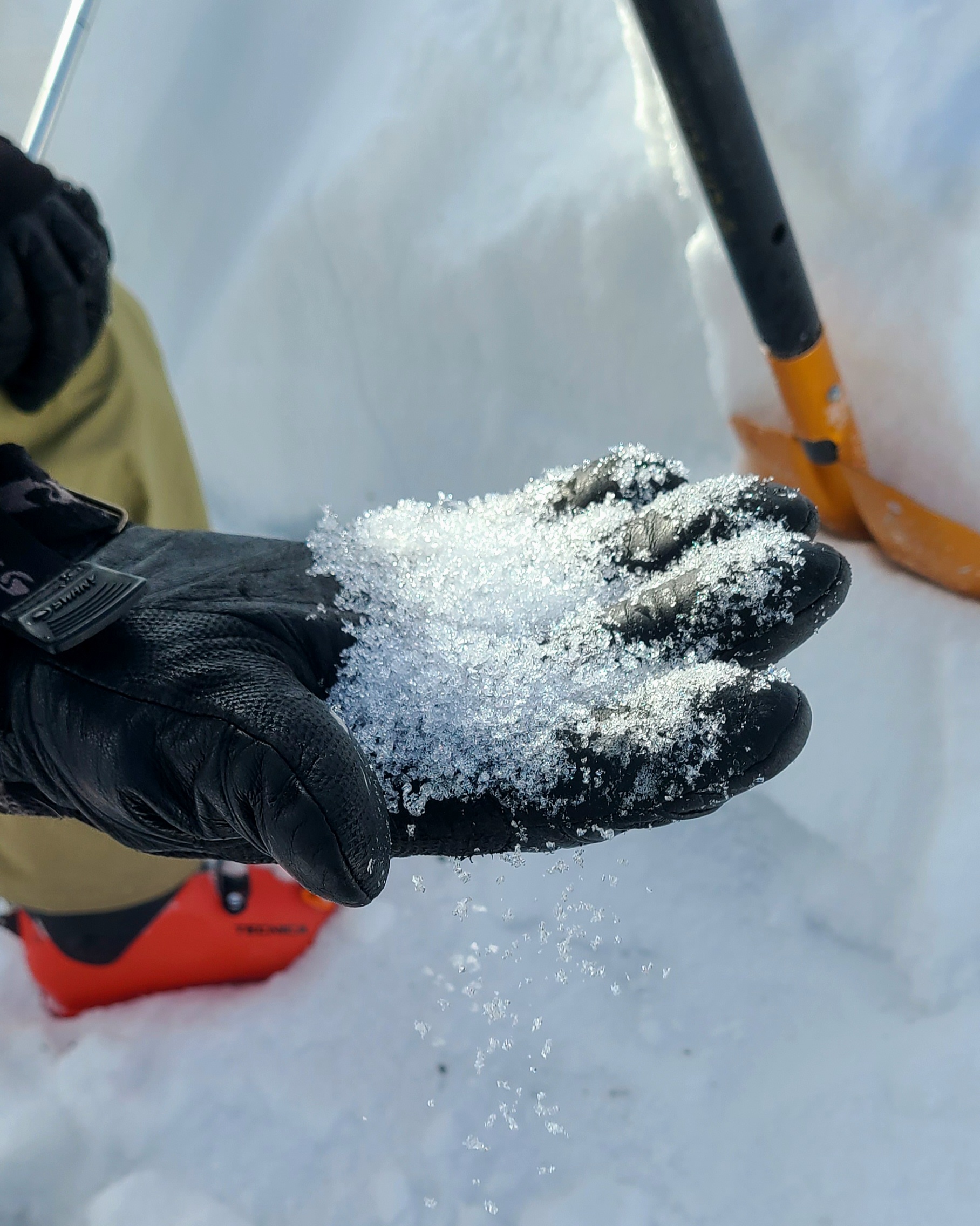
Weak, sugary, faceted snow... not a good foundation, particularly in terrain where the pack remains shallow. Thanks Kate W for the beautiful photo!
General Announcements
The Uinta weather station network was upgraded this summer and all that real-time info is found here. Simply click on the "Western Uinta" tab and then the "Weather Stations" tab to find all your weather needs.
We are always looking for snow and avalanche observations or just general riding conditions. So... if you see something, say something. You can reach our team directly by contacting: Craig at craig@utahavalanchecenter.org, 801-231-2170, or Andrew at andy@utahavalanchecenter.org, or 860-460-8142.
General Information
This forecast is from the U.S.D.A. Forest Service, which is solely responsible for its content. This forecast describes general avalanche conditions and local variations always occur. This forecast was issued on Tuesday, January 28th at 04:00AM and expires 24 hours after it was issued. We will update the forecast by 0700 AM tomorrow. But, in the meantime reach out to us with questions, or if you see anything in your travels.