Forecast for the Uintas Area Mountains

Issued by Craig Gordon on
Friday morning, January 10, 2025
Friday morning, January 10, 2025
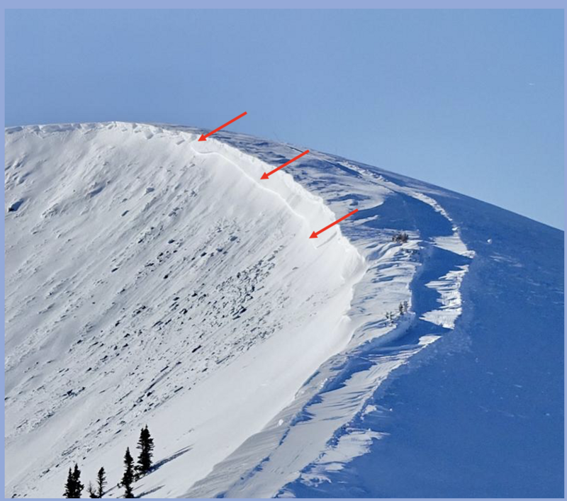
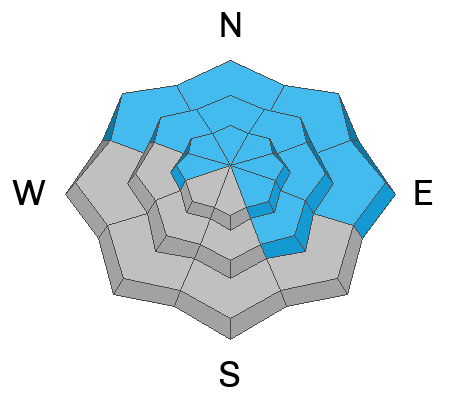
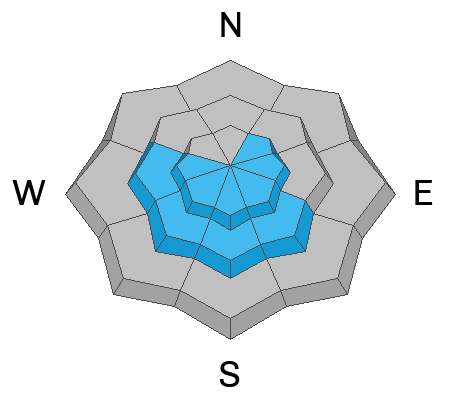
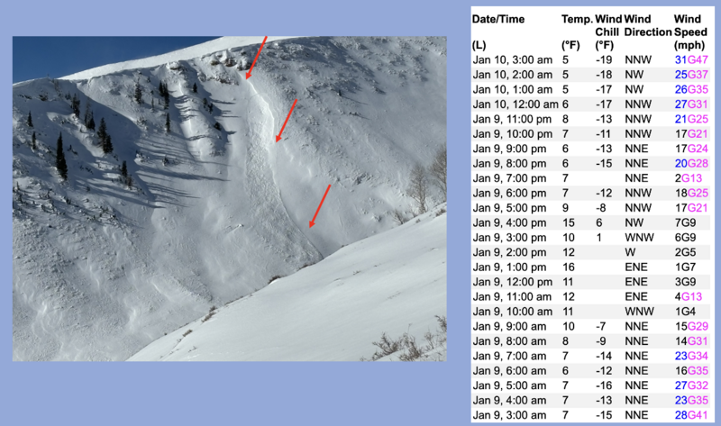
CONSIDERABLE avalanche danger is still found in the windzone, above treeline in terrain facing northwest through north through southeast. While pockety and becoming harder to initiate, human-triggered avalanches failing to old snow are LIKELY on steep, upper elevation slopes and may produce a slide breaking 2'-4' deep and hundreds of feet wide.
In addition, you'll encounter CONSIDERABLE avalanche hazard on the south half of the compass where recent winds whip up drifts sensitive to our additional weight. And while fresh drifts may seem more manageable and predictable, don't get let your guard down... even a small slide can quickly get out of hand, producing a larger avalanche than you might expect.
Mid elevation terrain offers MODERATE avalanche danger. Human triggered avalanches are POSSIBLE on steep, shady, wind sheltered slopes where you still might encounter a meaty slab that breaks to weaker layers buried in the mid portion of the snowpack.
So here's my exit strategy.... I'm finding quality riding, soft creamy snow, and generally LOW avy danger in wind sheltered, lower elevation terrain around the compass.

Low
Moderate
Considerable
High
Extreme
Learn how to read the forecast here