Current Conditions: Overnight temperatures dipped below freezing at most stations. West southwest wind is light to moderate with some stronger speeds along the most exposed locations. You'll find melt-freeze crusts on the surface at most locations.
Mountain Weather: A distinct change in weather starts today with colder air moving in tonight and a number of chances for snow through the rest of the week. We'll see clouds move in today. Temperatures should remain in the upper 20s to around 30. Southwest wind will be light to moderate in speed. There's a chance for a few inches of snow tonight. The next chance is Thursday when a more potent system moves through. It looks like there may be more periods of snow Friday night and into the weekend. If weather models are correct, this could add up to 1 to 2 feet of snow. It's still pretty early to call that out but we'll see how things progress.
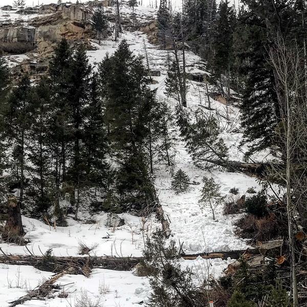
I found some minor wet natural avalanche activity in Huntington Canyon on Monday. The recent warm up produced some wet loose avalanches in a couple of the usual locations above the road and just downhill from the Forks of the Huntington. This was lower elevation on very steep east and northeast facing slopes where the snowpack was very thin. With cooler weather moving in again, this type of avalanche activity won't be a concern again until the next significant warm up.
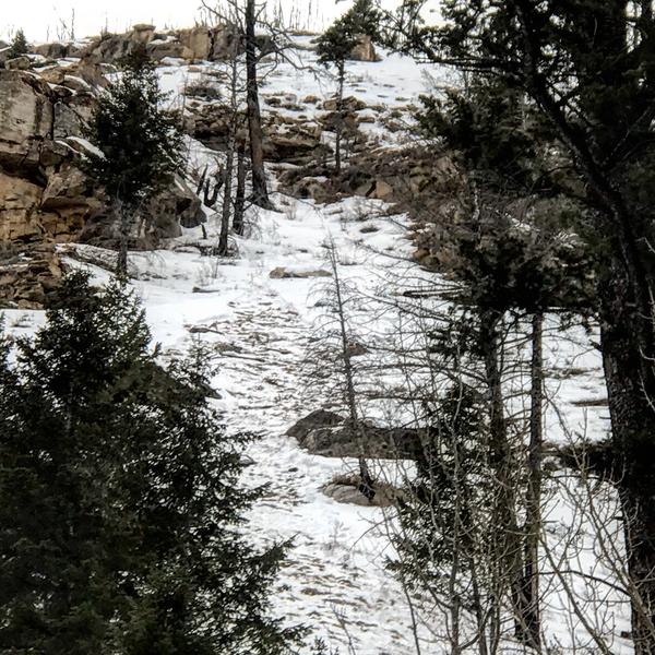
Photo below: Small pile of wet avalanche debris.
Photo below: This avalanche started out as a point release and fanned out gouging all of the thin snowpack down to the thin layer of faceted snow near the ground. Depending on how things warm up this spring, it's possible we may see the same type of thing in areas with a deeper snowpack.