Check out our Holiday Auction - Sign Up for the Utah Snow and Avalanche Workshop (USAW)

Forecast for the Skyline Area Mountains

Brett Kobernik
Issued by Brett Kobernik on
Sunday morning, March 24, 2024
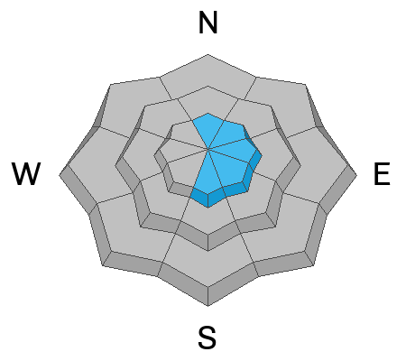
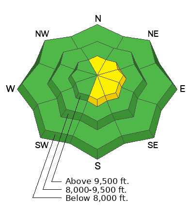
There is a MODERATE avalanche danger in the higher terrain.
New snow that has drifted into fresh slabs may be sensitive to people today.
The avalanches won't be all that large but don't let your guard down.
Low
Moderate
Considerable
High
Extreme
Learn how to read the forecast here
Weather and Snow
Current Conditions: A potent little cold front moved through last night and dropped 4 to 5 inches of new snow. This is slightly more than I anticipated. It should improve the riding conditions but I'm expecting a "dust on crust" feel to the snow today. Temperatures dropped into the teens and wind from the west northwest has been moderate in speed.
Mountain Weather: We'll have clouds today with the chance for a few more inches of new snow falling mid day. Wind will be light to moderate in speed from the northwest but it looks like it will pick up speed and maybe get a little breezy later this afternoon. We're going to have unsettled weather with periods of snow through the next week. None of the impulses look all that big but all together they should add up to a decent amount of snow.
Ad
Avalanche Problem #1
Wind Drifted Snow
Type
Location
Likelihood
Size
Description
The new snow won't pose all that much threat today. I anticipate the new snow to be fairly well behaved and triggering an avalanche will be unlikley. If you do trigger something, it will be relatively small. The most likely places to trigger a new snow avalanche will be in places where the wind has drifted the new snow. Steep north through east through south facing slopes are the most likely places to trigger something, especially just below exposed ridges. It looks like the wind will increase in speed this afternoon which will obviously drift snow.
General Announcements
This forecast is from the U.S.D.A. Forest Service, which is solely responsible for its content. This forecast describes general avalanche conditions and local variations always occur.