Current Conditions
It was a cold day on Thursday with light to moderate speed west wind. Riding conditions remain excellent. Overnight temperatures were in the single digits and the wind appears to have slowed even more.
Mountain Weather
We have low level clouds this morning shrouding the mountains. I'm hoping that they will dissipate as the day goes on but I'm not totally sure that will happen. It's going to be another cold one today with high temperatures potentially not making it out of the single digits. There will be some wind today from a west northwest direction but it shouldn't get too strong. Saturday looks clear with high temperatures warming to around 20˚F.
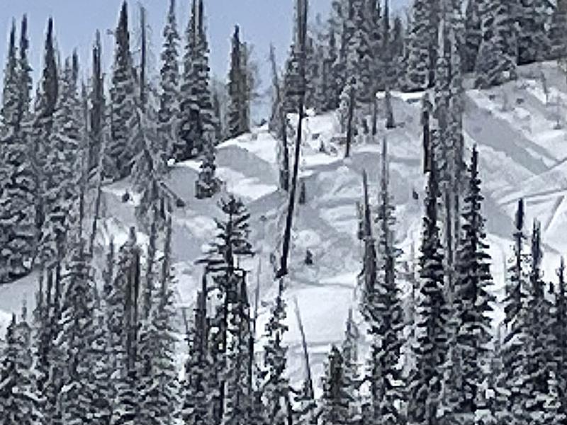
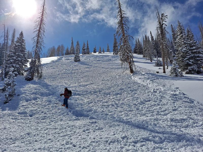
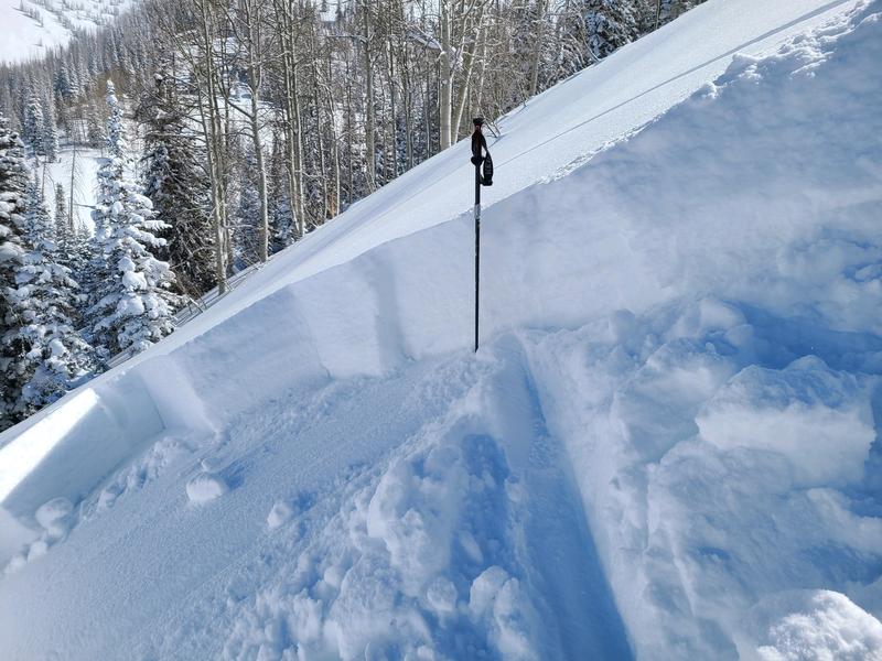
I had quite the day on Thursday of looking at recent avalanche activity. I went up Fairview Canyon and over to the Miller Flat trailhead. On the way I spotted the first significant slab avalanche that I've seen from these recent storms. It may have released naturally but my guess is that the snowmobiler who was near the toe had just triggered it:
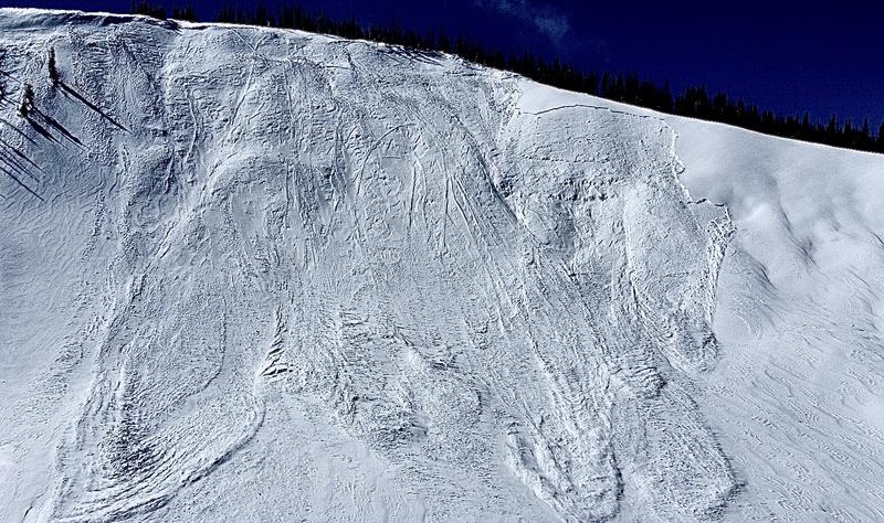
We unloaded and immediately spotted a large avalanche in lower Staker Canyon which we went to get a closer look at. This most likely released on Wednesday at the end of the storm:
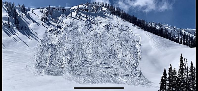
Next we climbed up a ridge and got a view of another large natural avalanche in Jordan Canyon:
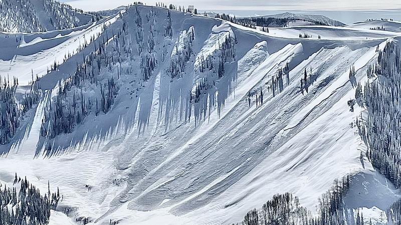
We gained the Skyline ridge and got to view a slew of natural avalanches in main Pleasant Creek as well as Coal Fork:
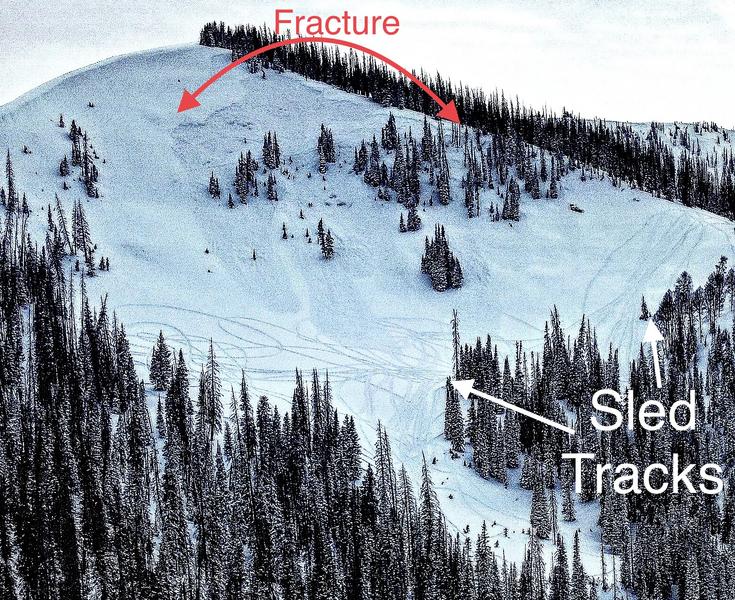
We descended Seeley Canyon and found a decent sized pocket in the south fork. We then worked back to the truck. As we were driving down I spotted this avalanche that was remotely triggered (triggered from a distance) by snowmobilers during the day. They were playing in the bottom of the bowl and triggered it. I appears that it overran a few of their tracks:
I got home and my friend Dale called me and told me that they had remotely triggered a deep avalanche while skiing Twin Creek: