Forecast for the Skyline Area Mountains

Brett Kobernik
Issued by Brett Kobernik on
Sunday morning, February 24, 2019
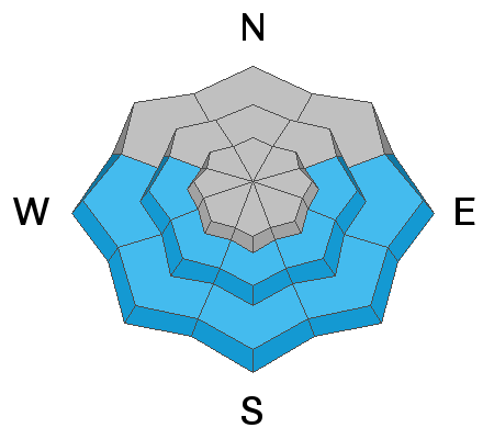
The overall avalanche danger is MODERATE today. HUMAN TRIGGERED AVALANCHES ARE POSSIBLE. Watch for sunny slopes to develop "pinwheels" or wet loose point release avalanches especially in the mid and lower elevations. A few fresh wind drifts may be lingering which could crack out on steep slopes.
If you don't push it too hard today and keep slopes less than 35 degrees, you'll probably have an awesome and safe day out in the mountains today. Continue to use caution and don't let your guard down.
Low
Moderate
Considerable
High
Extreme
Learn how to read the forecast here
Weather and Snow
I covered lots of territory from Mt Pleasant to the Skyline Mine on Saturday. Wind affect was the most significant thing I noticed. It was from the northwest with fairly steady moderate speeds along the upper ridges. However, it appears that it has stirred up the snow more than really loading slopes with large fresh drifts. You'll find that many of the upper bowls will have areas with stiff snow or wind crusts.
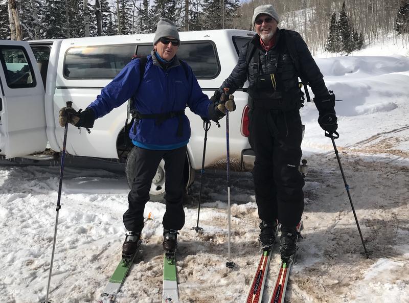
For the most part, riding conditions remain excellent. Just anticipate some areas in the higher terrain to have been hit by the wind. I bumped into Paul Terry and his crew of riders during my loop and had some fun yucking it up with them but forgot to get a photo. I also bumped into these old codgers, Steve and Virgil who were heading out to enjoy some of the pristine powder up by the mine.
High temperatures were only in the mid teens which was a bit warmer than the day before. It looks like another pretty nice day today and we should see highs around 20 today with light to moderate west southwest ridgetop wind.
Recent Avalanches
During my travels on Saturday I did not see any recent significant avalanche activity aside from the usual cornice failures along the windiest ridges. The most significant activity was from just over a week ago.
Ad
Avalanche Problem #1
Wet Snow
Type
Location
Likelihood
Size
Description
I did not notice any signs of the snow surface getting wet to the point that it was unstable on Saturday. You'll find sun crusts on many south facing slopes from the sun warming them on Saturday but I didn't notice many rollerballs or point release slides. My suspicion is that this won't be much of an issue with the gradually warming weather pattern over the next few days.
Avalanche Problem #2
Wind Drifted Snow
Type
Location
Likelihood
Size
Description
Again, I did not note that the wind was particularly loading many slopes during the day on Saturday. No doubt, there was snow getting transported so the likely places that you might find a drift that could crack out would be on the more east facing steep slopes along the higher ridgelines. This also is not all that much of a concern if you pay attention a little.
Avalanche Problem #3
Persistent Weak Layer
Type
Location
Likelihood
Size
Description
Probably the best news is that there have not been any significant avalanches breaking deep into the sugar snow from mid December. Where the snowpack is deep, it is becoming quite stable with good consolidation of those old weak layers. I did find places where my track was punching through into sugar snow in shallower locations as I was in the Trough Springs Ridge area near the Skyline mine. This area is generally shallower and has a weaker snowpack. This is the type of terrain where you still might find a slab avalanche that breaks into old sugar snow.
Additional Information
This forecast is from the U.S. Forest Service, which is solely responsible for its content. This forecast describes general avalanche conditions and local variations always occur.