Forecast for the Skyline Area Mountains

Brett Kobernik
Issued by Brett Kobernik on
Monday morning, February 17, 2020
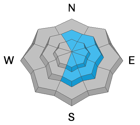
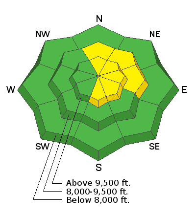
Outside of wind affected terrain the avalanche danger is fairly LOW. There is a MODERATE avalanche danger along the ridgelines on steep slopes on the east half of the compass. It's possible a person could trigger a small wind drifted snow avalanche today.
Low
Moderate
Considerable
High
Extreme
Learn how to read the forecast here
Weather and Snow
Current Conditions: The Skyline picked up 2 to 3 inches of new snow in the last 24 hours. The wind has been pretty strong along the higher terrain from the west northwest. It's hinting at slowing down. Overnight temperatures were around 20˚F.
Mountain Weather: The wind will continue to slow today. We'll see high temperatures in the low to mid 20s. We'll see plenty of sun through the remainder of the week and temperatures remain in the low to mid 20s for daytime highs. The next storm to affect our area looks like about a week away.
Ad
Avalanche Problem #1
Wind Drifted Snow
Type
Location
Likelihood
Size
Description
Fresh wind drifted snow is your main concern today. This probably won't pose much threat to people unless you're in very steep exposed easterly facing terrain. Ride or walk over small test slopes to see if they will crack out. This will give you an indication if the new drifts are sensitive.
Additional Information
This forecast is from the U.S. Forest Service, which is solely responsible for its content. This forecast describes general avalanche conditions and local variations always occur.