Forecast for the Skyline Area Mountains

Brett Kobernik
Issued by Brett Kobernik on
Sunday morning, December 8, 2019
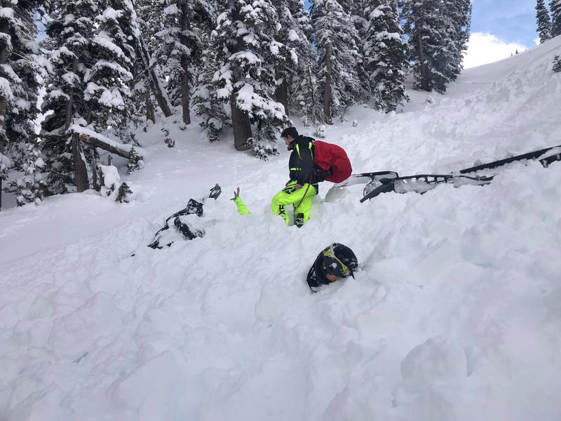
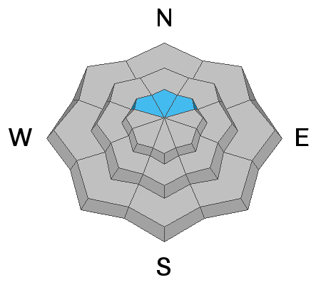
The overall avalanche danger is LOW to MODERATE. The new snow will slightly increase the avalanche danger today but not a whole lot unless we get more snow than anticipated. Places where a person could trigger an avalanche are upper elevations above about 9000' on slopes that face northwest, north and northeast that have a slope angle approaching 40 degrees.
Low
Moderate
Considerable
High
Extreme
Learn how to read the forecast here
Special Announcements
Need a Christmas present for your favorite backcountry partner? Get one of these cool t-shirts to support the UAC and other avalanche centers across the U.S.
As part of your early season tune-up, consider taking an avalanche class. We have lots of avalanche education classes listed already, from Know Before You Go to Companion Rescue to our Backcountry 101. Click on the Education menu on our webpage for a full list of classes from the UAC and other providers. Check out the Know Before You Go eLearning program for free, online, avalanche classes.
Weather and Snow
Temperatures remain mild this morning with many higher elevation stations just dropping below freezing. The wind is from the west southwest and is moderate in speed with a few stronger gusts at the highest locations.
A couple of inches of snow accumulated in the last few hours. The rain/snow level is probably somewhere around 7500'.
We should see periods of snow today. I'm expecting about another 4 inches or so. The temperature will gradually drop into the low 20s this afternoon. Wind will shift more northwest and gradually decrease.
Recent Avalanches
There was a close call in the Logan area mountains on Saturday where two riders were caught in an avalanche. Once was partialy buried. Both ended up ok. DETAILS HERE.
The partially buried rider's had is sticking up in the photo below.
Ad
Avalanche Problem #1
Persistent Weak Layer
Type
Location
Likelihood
Size
Description
The avalanche accident in the Logan mountains was caused by a layer of weak sugary snow near the ground. The Skyline has that same weak sugary layer on upper elevation northwest, north and northeast facing slopes. This layer has produced avalanches earlier in the weak and could cause problems yet in the future. Don't trust it. I'd continue to avoid the high elevation STEEP northerly facing slopes for right now.
Additional Information
This forecast is from the U.S. Forest Service, which is solely responsible for its content. This forecast describes general avalanche conditions and local variations always occur.