Forecast for the Skyline Area Mountains

Brett Kobernik
Issued by Brett Kobernik on
Friday morning, December 31, 2021
DANGEROUS AVALANCHE CONDITIONS CONTINUE TODAY AND WILL CONTINUE INTO THE WEEKEND.
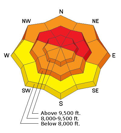
More new snow and lots of wind are keeping the avalanche danger HIGH.
Travel in avalanche terrain is NOT RECOMMENDED.
The good news is that the riding conditions are excellent almost everywhere. The abundant meadows and low angle slopes on the Skyline provide excellent opportunities for safely enjoying all the new snow.
Low
Moderate
Considerable
High
Extreme
Learn how to read the forecast here
Avalanche Warning
AN AVALANCHE WARNING HAS BEEN ISSUED FOR THE MOUNTAINS OF MUCH OF THE STATE OF UTAH, INCLUDING THE WASATCH RANGE...BEAR RIVER RANGE...UINTA MOUNTAINS...AND THE MANTI-SKYLINE.
THE AVALANCHE DANGER IS HIGH FOR THE WARNING AREA AND TRAVEL IN AVALANCHE TERRAIN IS NOT RECOMMENDED.
HEAVY SNOWFALL AND STRONG WINDS HAVE CREATED VERY DANGEROUS AVALANCHE CONDITIONS. BEING CAUGHT IN ANY AVALANCHE IS LIKELY TO BE UNSURVIVABLE. STAY OFF OF AND OUT FROM UNDER SLOPES STEEPER THAN 30 DEGREES.
Weather and Snow
Current Conditions
All the new snow is getting crazy. The Skyline received another 6 to 10 inches in the last 24 hours. Some locations are over a foot of new snow since yesterday morning. This was another windy period with LOTS of drifting happening. Temperatures are around 20˚F. Riding conditions were outstanding on Thursday and should be excellent again today out of the wind effected terrain.
Mountain Weather
More snow is expected today with another 6 to 10 inches possible. Considering how the storms have been performing, I wouldn't be surprised to see a bit more. Snow will taper off tonight. The westerly wind should slow during the day. Colder air is moving in and temperatures are going to continue to drop and will be in the single digits tonight. We'll see clearing on Saturday with cold temperatures. Highs will be in the low single digits. Sunday is clear also with temperatures rebounding into the upper teens.
Ad
Avalanche Problem #1
Persistent Weak Layer
Type
Location
Likelihood
Size
Description
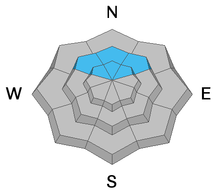
Any slab avalanche that releases and breaks into the persistent weak layer of weak, sugary faceted snow near the ground is going to be very deep and most likely unsurvivable. The only thing you can do right now is avoid avalanche terrain. The most dangerous slopes are in the mid and upper elevation northwest, north and northeast facing slopes. This is where the old sugary snow from October still remains.
Avalanche Problem #2
Wind Drifted Snow
Type
Location
Likelihood
Size
Description
We keep adding more snow and the wind keeps blowing it into deep drifts. These drifts alone (where they form with no old sugary snow from October) can be dangerous. The wind was west southwest so much of the drifting and loading occurred on the more east facing slopes. However, the valleys and ridges that make up the convoluted terrain of the mountains can channel wind in all directions. This means that you can find sensitive drifts on slopes that face all sorts of different directions. Again, avoiding avalanche terrain is the best bet right now.