Forecast for the Skyline Area Mountains

Brett Kobernik
Issued by Brett Kobernik on
Sunday morning, December 22, 2019
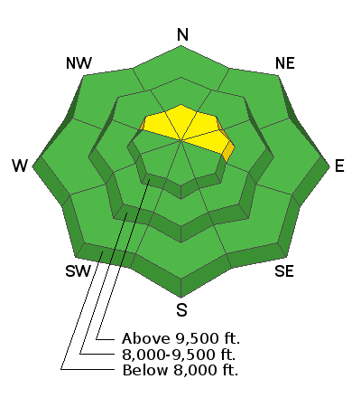
The avalanche danger is generally LOW. There is a slightly heightened danger in the upper elevations where recently formed wind drifts may release on very steep slopes. Use normal caution while traveling and don't let your avalanche guard down. Continue to look for "pillowy" looking drifts of snow and avoid those that are on very steep slopes.
Low
Moderate
Considerable
High
Extreme
Learn how to read the forecast here
Weather and Snow
Unseasonably warm temperatures have been helping to consolidate the snowpack. These warm temperatures have kept the surface from turning into faceted sugary snow. It is not uncommon during dry periods to have the surface "facet" and become loose which then can act as a weak layer once it gets buried. Typically, cold December temperatures would make this happen.
The second thing that the warm temperatures are doing is helping settle and strengthen the deeper layers including the faceted sugar snow on the ground in the higher more northerly facing terrain.
LINK TO VIDEO

Weather:
I'm expecting mostly cloudy skies and increasing southwest wind today. The wind may be pretty strong by the end of the day.
The next storm starts moving in with a southwest flow on Tuesday. We may see some light snow. Currently it looks like we'll get a good shot of snow on Christmas in the 5 inch range. Then another period should bring another 4 inches or so later on Thursday. Temperatures will cool off after Tuesday and remain cold through the week. It doesn't look all that windy during the storm. It's possible the lack of wind will hamper "orographic lift" which may limit snowfall.
Recent Avalanches
There have not been any significant avalanches reported since early December.
Ad
Avalanche Problem #1
Normal Caution
Type
Location
Likelihood
Size
Description
At this point, it's fairly unlikely that a person will trigger a serious avalanche. It's still possible that a person could find a pocket to release if you're really trying. Places to do that would be slopes of 40 degrees or steeper in the upper elevations. Wind drifts that formed this week seem stubborn at this point but you might get one to pop out on very steep terrain. Some northerly facing slopes hold weak sugar snow on the ground. These slopes seem to be mainly located in the central Skyline from about Pleasant Creek down to Manti Canyon. These locations received the most snow in October which hung around and turned into faceted sugar. Time will tell if they will become active again once we get another significant load of snow.
Additional Information
This forecast is from the U.S. Forest Service, which is solely responsible for its content. This forecast describes general avalanche conditions and local variations always occur.