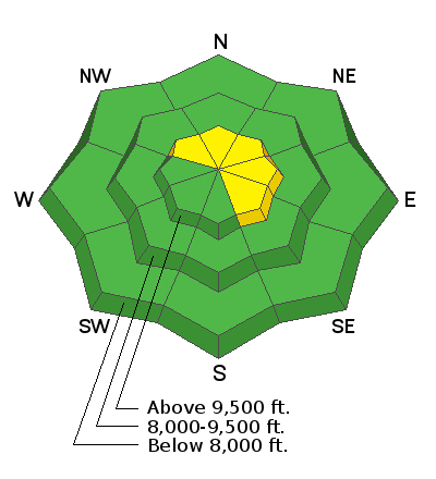
Forecast for the Skyline Area Mountains

Issued by Brett Kobernik on
Tuesday morning, December 18, 2018
Tuesday morning, December 18, 2018
The majority of the terrain along the Skyline has a LOW avalanche danger today. There is still a "pockety" MODERATE danger in the highest terrain on northwest through east facing steep slopes. As time goes on, chances for triggering an avalanche become less.
- Wind drifted snow from last Wednesday's windy storm may still be sensitive to a person along the more east facing ridgelines.
- There is still a slight chance that a person could trigger an avalanche breaking into old sugar snow near the ground on the higher northwest, north and northeast facing slopes.

Low
Moderate
Considerable
High
Extreme
Learn how to read the forecast here


