Forecast for the Skyline Area Mountains

Brett Kobernik
Issued by Brett Kobernik on
Friday morning, December 13, 2019
THE AVALANCHE DANGER WILL INCREASE TODAY AS STRONG WIND CONTINUES AND SNOWFALL IS EXPECTED.
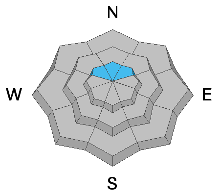
The avalanche danger is currently MODERATE. Drifting snow may form drifts that are sensitive to a person. Additional snowfall may overload weak sugar snow near the ground on high elevation northwest, north and northeast facing slopes.
Low
Moderate
Considerable
High
Extreme
Learn how to read the forecast here
Weather and Snow
A couple of inches of snow trickled in mainly on the more northern end of the Skyline. Wind has been fairly strong along the exposed ridges from the west northwest. The wind has been blowing down into the canyons also.
The wind should ease up a bit mid day but will ramp back up again tonight with continued strong speeds. Weather models are still indicating about a foot of snow for our region through Saturday. The storm will be mostly done Sunday and we'll probably be able to get out and have a good look around.
Ad
Avalanche Problem #1
Persistent Weak Layer
Type
Location
Likelihood
Size
Description
The big question is how will the old buried weak sugar snow near the ground react to the anticipated storm? Good things about the current snowpack are that the snow above the weak sugar snow is VERY strong. It may be strong enough to hold 12" of new snow without it breaking into the old snow. The other thing is that I have seen at least one location where the old weak sugar snow is now becoming damp near the base. This is good news as it makes the old sugar more cohesive. The other good thing is that there are lots of slopes that don't have old weak snow near the ground. The bad thing is that I've had recent snowpit tests fail and propagate easily, breaking into the old weak sugar snow. The bottom line is that you can't ever trust faceted sugar snow that is buried in the snowpack. We'll have to wait until the storm is over and see how that old weak snow reacted to the new snow and wind.
Avalanche Problem #2
Wind Drifted Snow
Type
Location
Likelihood
Size
Description
The wind will be forming fresh drifts all over the place. The biggest drifts will be on the more east facing slopes but use caution and watch for fresh drifts on all aspects.
Additional Information
This forecast is from the U.S. Forest Service, which is solely responsible for its content. This forecast describes general avalanche conditions and local variations always occur.