Check out our Holiday Auction - Sign Up for the Utah Snow and Avalanche Workshop (USAW)

Forecast for the Skyline Area Mountains

Brett Kobernik
Issued by Brett Kobernik on
Thursday morning, November 28, 2024
The overall avalanche danger is currently CONSIDERABLE.
There have been natural and human triggered avalanches over the last 24 hours.
Human triggered avalanches are likely today if you are getting onto steep slopes above 8000 feet in elevation.
Low
Moderate
Considerable
High
Extreme
Learn how to read the forecast here
Weather and Snow
Current Conditions: Riding conditions were deep on Wednesday. Trench warfare on sleds. Step off your machine or skis and you sink right to the ground. Total depths in the higher terrain are right around 3 feet. The new snow is fairly dense so you can actually travel around. Overnight temperatures were in the low to mid teens and the wind from the northwest was fairly light.
Mountain Weather: We move into a prolonged period of mild weather starting today. We'll see mostly clear skies with high temperatures in the low 20s and light to moderate speed west northwest wind. The forecast looks the same for the foreseeable future although with a gradual warming trend.
Recent Avalanches
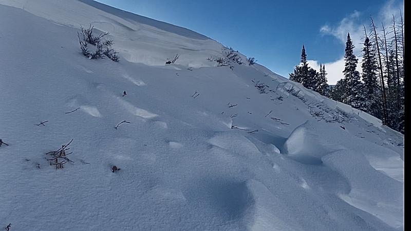
There was lots of "pockety" avalanche activity during the tail end of the storm as well as a few small snowmobile triggered slides on Wednesday. The avalanches were breaking about 2 1/2 feet deep. They ranged from 100 to 200 feet wide. None of them ran all that far because they were all on fairly small slopes. Photo below is an example of what type of avalanches occurred.
List of known activity. Click for more details and photos:
Early Philidelphia Flats
Mid Philidelphia Flats
North Haystack
Gooseberry-Fish Lake
Ad
Avalanche Problem #1
Persistent Weak Layer
Type
Location
Likelihood
Size
Description
All the signs are there. Recent avalanches. Collapsing. Poor snowpack structure with weak sugary snow at the base. Poor stability test results. What more do you need? It should be obvious from all these clues that we have an unstable snowpack. You're going to want to avoid the steep slopes through the rest of the week and weekend.
General Announcements
This forecast is from the U.S.D.A. Forest Service, which is solely responsible for its content. This forecast describes general avalanche conditions and local variations always occur.