Forecast for the Skyline Area Mountains

Issued by Brett Kobernik on
Wednesday morning, November 13, 2019
PRE-SEASON UPDATE:
We've had a small amount of snow accumulate along the Manti Skyline so far this season. Much of it has melted off. Northerly facing slopes continue to hold snow. Often we worry that early snow will turn into a weak layer of sugary faceted snow and will cause avalanches once it gets buried. At this point, there is not enough on the ground to be a widespread concern. I'll update the avalanche forecasts as conditions warrant.

Low
Moderate
Considerable
High
Extreme
Learn how to read the forecast here
General Announcements
While we wait for winter to kick in, we're busy getting ready at the Utah Avalanche Center. We are changing batteries, greasing bearings, checking our safety gear, and updating the website. We have lots of avalanche education classes listed already:
- Avalanche Classes by various providers
- Avalanche Classes by the Utah Avalanche Center
-
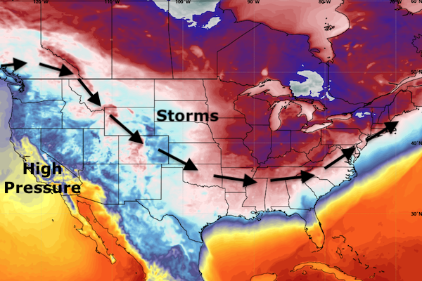
The dominant weather pattern over the last month has been high pressure over the west coast with storm troughs swooping through east of Utah. A few storms did sneak through Utah which gave us the small amount of snow that is in the mountains.

It looks to me like this pattern will more or less continue for the next couple of weeks. There is a weak storm system that will graze northeast Utah this weekend. There is another small storm that looks like it will bust through the ridge of high pressure and produce a little snow about mid week next week. Otherwise, nothing to get too excited about at this point.