Forecast for the Skyline Area Mountains

Brett Kobernik
Issued by Brett Kobernik on
Tuesday morning, January 3, 2023
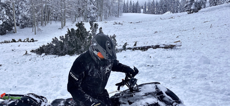
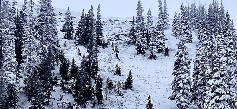
The overall avalanche danger is rated HIGH today.
Large and deadly human triggered avalanches are likely.
Safe riding can be done as long as you stay off slopes steeper than 30˚.
Be sure to stay out from underneath steep slopes as you could trigger an avalanche from below.
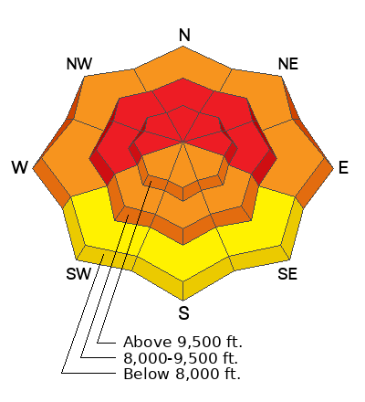
Low
Moderate
Considerable
High
Extreme
Learn how to read the forecast here
Weather and Snow
Current Conditions: Periods of light snowfall added another 3 inches of snow in the last 24 hours. Riding conditions are excellent. Temperatures have been in the mid teens. The wind has been from the west southwest and has been generally light with some moderate speeds along exposed ridges.
Mountain Weather: We'll have cloudy skies today with the chance for light snowfall this afternoon with an inch or two possible. Temperatures will remain in the mid teens. The wind will be from the west and it looks like speeds will increase a bit today but won't get real strong. We'll have a little break in the weather Wednesday and Thursday then another small storm moves through Thursday night into Friday morning.
Recent Avalanches
There was a massive avalanche that released in Ephraim Canyon during the day on Monday. It was most likely triggered by snowmobilers a few hundred yards away while they were riding in adjacent terrain. This clearly shows that the snowpack has not adjusted to the huge load of snow we just received. DETAILS AND MORE PHOTOS HERE
Ad
Avalanche Problem #1
Persistent Weak Layer
Type
Location
Likelihood
Size
Description
GOOD NEWS: The big storm we just had is about the best thing in the long term for the Persistent Weak Layer that formed in November. This weak layer has been active through December and continues to produce avalanches. All the weight from the recent snow will gradually (gradually is the key word) compress the old sugary snow and make it stronger and more stable.
BAD NEWS: The November Persistent Weak Layer is still unstable and active right now. It will take a little time until it is completely stable. The big question is "how much time?" There is no definitive answer. Hopefully we'll see signs of stability as the week progresses. Until then, CONTINUE TO USE EXTREME CAUTION IN THE BACKCOUNTRY.
General Announcements
This forecast is from the U.S.D.A. Forest Service, which is solely responsible for its content. This forecast describes general avalanche conditions and local variations always occur.