Forecast for the Skyline Area Mountains

Brett Kobernik
Issued by Brett Kobernik on
Monday morning, January 20, 2020
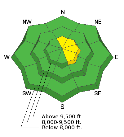
For the most part, avalanche conditions are pretty safe and we have an overall LOW danger. A MODERATE danger exists in higher elevation steep terrain with recent wind drifted snow. As time goes on, the chances for triggering something become less until the next storm.
Low
Moderate
Considerable
High
Extreme
Learn how to read the forecast here
Weather and Snow
Current Conditions: Riding conditions remain excellent in many locations. You will also find areas where the wind from last week has created stout wind crusts. Many areas have a well consolidated supportable snowpack. Shallower locations are "punchy" and you'll find some faceted sugar snow when you sink through. We will want to keep an eye on these spots once they get loaded up with new snow.
Mountain Weather: Looks like a mostly cloudy day today with mild temperatures and light to moderate wind from the southwest. A weak storm will move through Tuesday night into Wednesday bringing a few inches of new snow.
Ad
Additional Information
This forecast is from the U.S. Forest Service, which is solely responsible for its content. This forecast describes general avalanche conditions and local variations always occur.