Forecast for the Salt Lake Area Mountains

Trent Meisenheimer
Issued by Trent Meisenheimer on
Sunday morning, April 6, 2025
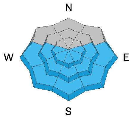
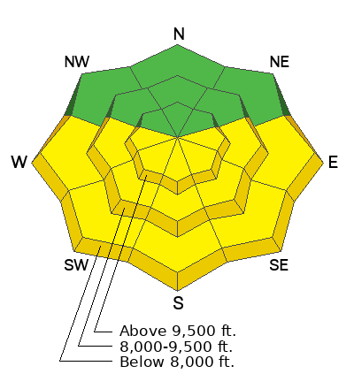
This morning, the overall avalanche danger is LOW and Normal Caution is advised. On slopes facing east, southeast, south, southwest, and west, the avalanche danger for wet snow will quickly rise to MODERATE and could rise to CONSIDERABLE as strong sunshine and warming temperatures heat the snow, making it unstable.
Low
Moderate
Considerable
High
Extreme
Learn how to read the forecast here
Special Announcements
Motorized Users—Please consider taking this 5-minute survey to help researchers better understand avalanche education participation and safety preparedness. Responses are anonymous and confidential.
Weather and Snow
Under clear skies, mountain temperatures range from 17 to 25 °F. The wind is from the northwest, blowing 5-15 mph across most of the upper elevations. At 11,000', the wind is a bit stronger blowing from the northwest, 20-25 mph, gusting 30.
Today will be another beautiful day with plenty of sunshine as high pressure takes hold. Temperatures will warm up a bit faster this afternoon, climbing into the low to mid-40s °F. The wind will remain from the northwest and blow 5-15 mph, with some higher peaks having gusts into the 30s.
Yesterday's warm temperatures and strong sunshine melted the snow surface at low elevations and on sunny aspects, and this morning, you will find a crust there. However, many people still found excellent riding and turning conditions on shady slopes at the mid and upper elevations.
Recent Avalanches
No new avalanches were reported to the UAC. However, two people took rides in avalanches on Friday. See the recent avalanche list HERE.
Ad
Avalanche Problem #1
Normal Caution
Type
Location
Likelihood
Size
Description
This is not a specific avalanche problem. It is used by UAC forecasters most often when avalanche conditions are generally safe and there is no predominate avalanche problem. Any avalanche type is possible but the most common would be wind slab, loose wet, and loose dry avalanches and they would be expected to be small. Do not approach a Normal Caution avalanche problem as an “anything goes” situation. Continue to keep your guard up and look for any signs of snow instability. Evaluate snow and weather conditions as you travel.
Remember, terrain selection will increase or decrease the consequences of being caught in small avalanches. I would continue to be on the lookout for the following:
1. New Snow: Sluffing and shallow soft slabs of new snow could fail in different density inversions within the recent storm snow. These avalanches would likely be 1-2 feet deep and up to 100 feet wide. Use slope cuts before committing to steep terrain, and only expose one person at a time to avalanche terrain.
2. Wind-Drifted Snow: The wind has been almost non-existent. However, I would always be on the lookout for slopes with recent drifts of wind-blown snow.
Avalanche Problem #2
Wet Snow
Type
Location
Likelihood
Size
Description
With another round of strong sunshine and warming temperatures, we can expect the daily cycle of melt-freeze on sunny aspects to continue. Remember, if the snow is becoming damp or unsupportable and you're seeing roller balls on any aspect or elevation, it's time to get out of there.
Plan your exits today and remember the aspects above you can be cooking in the sun while you're in the shade below. Wet snow avalanches can run long distances and pile up deeply in gullies and other terrain traps.
General Announcements
This information does not apply to developed ski areas or highways where avalanche control is normally done. This forecast is from the U.S.D.A. Forest Service, which is solely responsible for its content. This forecast describes general avalanche conditions and local variations always occur.