Join us at our 2nd Annual Blizzard Ball

Forecast for the Salt Lake Area Mountains

Trent Meisenheimer
Issued by Trent Meisenheimer on
Sunday morning, November 24, 2024
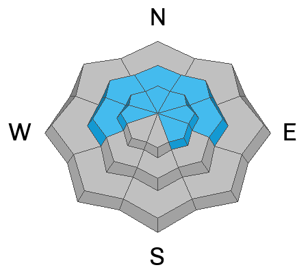
A MODERATE avalanche danger exists on mid and upper-elevation steep slopes facing west to north and east. There is also a MODERATE avalanche danger on upper-elevation southeast-facing terrain. Here, it is possible for humans to trigger an avalanche that fails on a persistent weak layer of faceted snow.
Loud audible collapses or shooting cracks should be enough of a red flag to alter your plans or stick to terrain under 30 degrees in steepness. Remember that traumatic injury is likely with any avalanche involvement this early season.
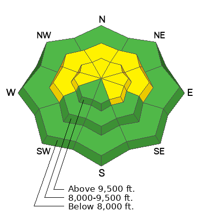
Low
Moderate
Considerable
High
Extreme
Learn how to read the forecast here
Weather and Snow
It's snowing!!! Overnight totals are 2-4 inches of new snow with 0.17-0.31 inches of water. Current mountain temperatures range from 15-25 °F. The wind has finally calmed down and is now blowing from the west-northwest across the upper-elevation terrain at speeds of 5-10 mph with gusts into the low 20s.
Today, we expect it to continue snowing through the morning hours, with the heaviest snowfall around 8:00 AM. The National Weather Service calls for 4-8 inches of snow with 0.2-0.50 inches of water throughout the day. Temperatures will climb into the upper 20s °F. The wind will continue blowing from the west-northwest and should remain relatively calm with 5-10 mph speeds across the upper elevations. Snowfall will wind down this afternoon, followed by partly cloudy skies.
There will be a short break in the action on Monday before another more potent storm arrives overnight and lasts into Wednesday. Right now, this looks like feet of snow and inches of water.
Recent Avalanches
Many observations of weak faceted snow and poor snowpack structure have been reported by backcountry observers. Read all the observations HERE.
Ad
Avalanche Problem #1
Persistent Weak Layer
Type
Location
Likelihood
Size
Description
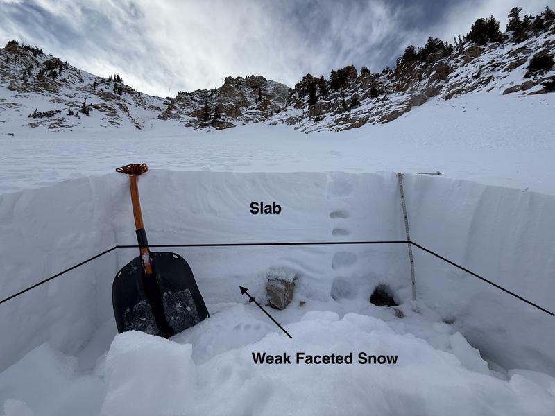
Sorry to be the bearer of bad news here. BUT, we have a shallow, weak, and faceted snowpack throughout northern Utah, especially on the slopes facing the north (shady) side of the compass (see locator rose). I am unsure if today's water weight (snow) will be enough to tip the scales, but it's time to change our mindset as this snow stacks up.
Today, human-triggered avalanches 1-3 feet deep and up to 100 feet wide are possible. These avalanches can be triggered remotely (from a distance). Collapsing and shooting cracks will be the obvious clues to unstable snow.
Photo: Upper Little Cottonwood Canyon showing the snowpack structure on a north-facing slope at 10,200'.
Avalanche Problem #2
Wind Drifted Snow
Type
Location
Likelihood
Size
Description
For the past 48 hours, the south wind has blown relentlessly, with speeds averaging 15-30 mph, gusting into the 40s and 50s. Today's new snow will undoubtedly cover and hide yesterday's wind-drifted snow, and I would be very cautious across the mid and upper-elevation wind-loaded terrain. Any wind-drifted snow avalanche will likely break deeper into faceted snow.
Grainger and Kelly went looking for wind-drifted snow over faceted (weak) snow yesterday and easily found propagation in snowpit tests. See their observation HERE.
Avalanche Problem #3
New Snow
Type
Location
Likelihood
Size
Description
As the storm intensifies this morning and if precipitation hits 1-2 inches of snow per hour, we could see small dry-loose or new snow soft slab avalanches in steep terrain. This problem is more of a mention. The real problem will be the Persistent Weak Layer (see above).
General Announcements
This information does not apply to developed ski areas or highways where avalanche control is normally done. This forecast is from the U.S.D.A. Forest Service, which is solely responsible for its content. This forecast describes general avalanche conditions and local variations always occur.