Forecast for the Provo Area Mountains

Mark Staples
Issued by Mark Staples on
Tuesday morning, April 7, 2020
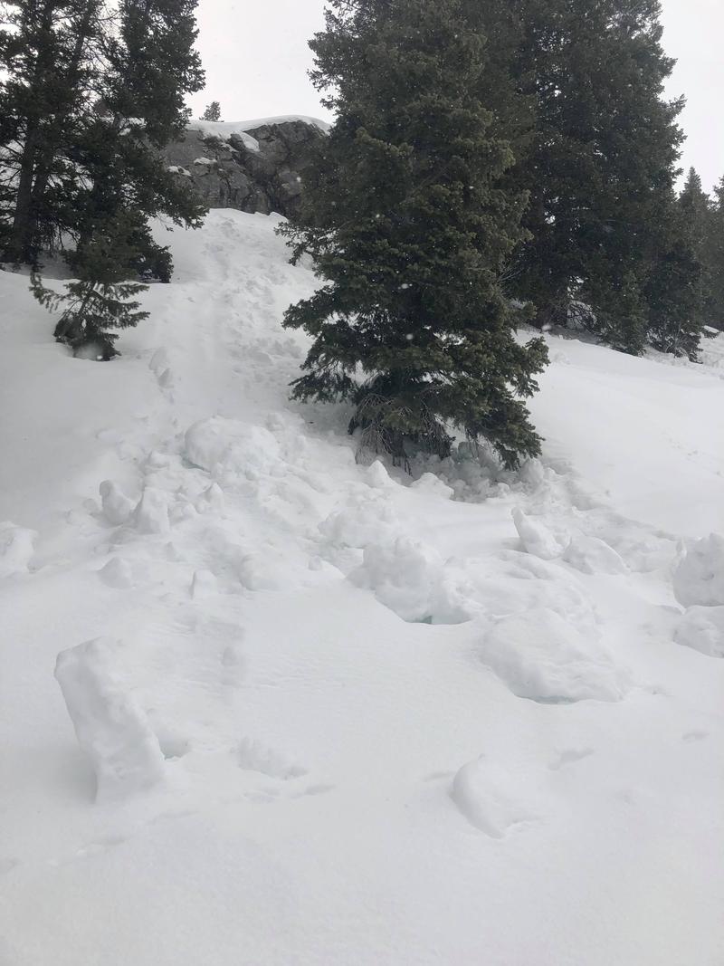
Today the avalanche danger is MODERATE at all elevations and aspects. On upper elevation, northerly facing slopes with dry snow, triggering slabs of wind drifted snow is possible. On all other slopes, loose wet avalanches will become possible as the snow warms and becomes wet.
Low
Moderate
Considerable
High
Extreme
Learn how to read the forecast here
Special Announcements
Spring Awareness Campaign - Help us save lives through avalanche forecasts and education. Consider making a donation before April 8th.
Uncertainty, Risk, & Decision Making: before, during, and after COVID-19 - Read this thought-provoking blog post about how we take risks by guest author Tom Diegel.
Weather and Snow
This morning temperatures are mostly in the mid 30s F. Ridgetop winds are blowing 15 mph from the southwest and gusting 20-30 mph.
Today will have mostly sunny skies and high temperatures approaching 50 degrees F. Winds may decrease some this afternoon and a few clouds may build and drop a trace of snow.
Recent Avalanches
No avalanches have been reported in the Provo area mountains. Further north in the Cottonwood Canyons which received 5-10 inches of snow this weekend, may people triggered soft slabs of wind drifted snow.
Ad
Avalanche Problem #1
Wind Drifted Snow
Type
Location
Likelihood
Size
Description
If you're looking for dry snow, it mostly exists on upper elevation, north-facing slopes, BUT these slopes are ones where you may find soft slabs of wind drifted snow. Many of these wind slabs should have bonded and stabilized, but some may remain possible to trigger. Several observers reported snow transport still occurring yesterday at the highest elevations. That continued loading means wind slabs can be triggered today.

CORNICES - Cornices in some places are massive. These monsters are unpredictable especially during warm weather when they start bending downhill. Avoid being under or near the tops of large cornices.

Avalanche Problem #2
Wet Snow
Type
Location
Likelihood
Size
Description
Strong sunshine and warm air temperatures today should quickly warm the snow surface. As the snow becomes wet and loses cohesion, loose wet avalanches will be possible. Slopes with exposed rocks tend to heat up the most as rocks readily absorb solar radiation and add additional heat to the surrounding snow. These areas may produce some wet loose avalanches naturally.
Pay attention to how wet the snow becomes. The wetter it becomes the more likely it will be for wet avalanches to occur. Also watch for pinwheels and rollerballs tumbling downhill. Seeing more and more of these balls of snow roll downhill indicates that the likelihood of wet avalanches is increasing. Avoid being in creek bottoms or gullies as the snow gets wet because even small avalanches can be deadly in these confined areas.
The photo below shows a small rock band yesterday that warmed and caused roller balls of snow to fall downhill.
Additional Information
Information on outdoor recreation - The State of Utah created this webpage with information about recreating on both state and federal public lands during the current health crisis.

Skiing and riding at closed ski resorts - Some resorts allow access now, and some do not. Please check HERE for the latest info on ski area access.

New to the backcountry (including riding at closed resorts) - Watch the award-winning, 15 minute Know Before You Go video, or take the 5-part, free online-learning series.
General Announcements
This information does not apply to developed ski areas or highways where avalanche control is normally done. This forecast is from the U.S.D.A. Forest Service, which is solely responsible for its content. This forecast describes general avalanche conditions and local variations always occur.