Forecast for the Provo Area Mountains

Drew Hardesty
Issued by Drew Hardesty on
Sunday morning, April 5, 2020
Most terrain has LOW avalanche danger. Low danger does not mean No danger.
Isolated pockets of wind drifts may be found in the highest elevations and the open wind-swept bowls. Cornices should be avoided at all cost.
I don't like the warm overnight temperatures and cloud cover. Wet loose avalanches may be possible on many aspects and elevations with daytime highs into the 40s and 50s.
Low
Moderate
Considerable
High
Extreme
Learn how to read the forecast here
Special Announcements
Spring Awareness Campaign - Help us save lives through avalanche forecasts and education. Consider making a donation before April 8th.
We are sad to share the news of two recent avalanche fatalities:
On Wednesday, Trace Carrillo died in an avalanche on Taylor Mountain near Teton Pass. Trace was formerly an intern with the UAC and more recently a wilderness ranger with the Forest Service. Article here. Preliminary report here.
On Friday, Rob Kincaid died in an avalanche just north of Palisades Reservoir near the ID/WY stateline. Rob was well known by many snowmobilers as an athlete for Arctic Cat and veteran of many snowmobile competitions. Article here. Preliminary report here.
More details should be available soon about these tragic events but initial reports are that both men were wearing avalanche transceivers that were not turned on.

January 5, 2019 - Read this collection of 6 stories and a podcast about that day with a low avalanche danger, 8 skier-triggered avalanches, four catch and carries, a partial and critical burial, and a trip to the emergency room.
Weather and Snow
Skies are overcast with a light rain/snow mix in the mountains. I'd imagine a trace to an inch of new snow up high.
Mountain temperatures are in the mid to upper 30s. Southwest wins are blowing 20-25mph with gusts to 40.
For today, we'll have occasional snow showers and intermittent sun-breaks. Temps will rise to the mid-30s along the high peaks and near 50°F down low.

The weather models have us a bit between the jet stream to the north and a cut-off Low pressure storm system to the west. This storm will move inland and well to the south of us in the early part of the week.
Recent Avalanches
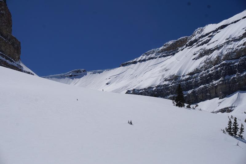
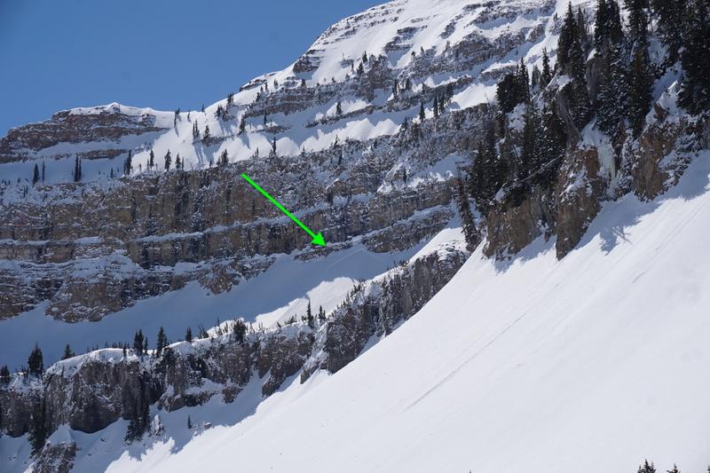
Pro observer Kory Davis noted some recent larger slab avalanches in Primrose Cirque and what appears to be off the Timp summit ridge yesterday.Saturday Photos below. They appear to be triggered by cornice fall or sluffs cascading from above.
Ad
Avalanche Problem #1
Normal Caution
Type
Location
Likelihood
Size
Description
Avalanche issues are few, but worth mention.
  • Yesterday a party headed to steep high elevation terrain noted plumes and wind transport along the ridgeline and wisely turned around. Pockety wind drifts may still be found in localized terrain and more likely along the highest elevations on northwest to east...and perhaps crossloaded on south facing terrain. Rememer that even a small wind slab can be problematic in no-fall terrain.
  • I don't like the warm overnight temperatures, particularly with cloud cover. Wet avalanches are possible today with daytime heating and occasional sunbreaks. If the snow starts to feel punchy and unsupportable.....and you're seeing rollerballs and pinwheels, it's time to head to cooler aspects, lower angle terrain, or to the house.
  • Cornices are looming large along the ridgelines and have begun to calve off. 5% of our avalanche fatalities are due to cornice fall. Take extra caution.
Additional Information
Information on outdoor recreation - The State of Utah created this webpage with information about recreating on both state and federal public lands during the current health crisis.

Skiing and riding at closed ski resorts - Some resorts allow access now, and some do not. Please check HERE for the latest info on ski area access.

New to the backcountry (including riding at closed resorts) - Watch the award-winning, 15 minute Know Before You Go video, or take the 5-part, free online-learning series.
General Announcements
This information does not apply to developed ski areas or highways where avalanche control is normally done. This forecast is from the U.S.D.A. Forest Service, which is solely responsible for its content. This forecast describes general avalanche conditions and local variations always occur.