Join us at our 2nd Annual Blizzard Ball

Forecast for the Provo Area Mountains

Drew Hardesty
Issued by Drew Hardesty on
Friday morning, April 17, 2020
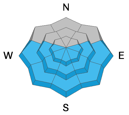
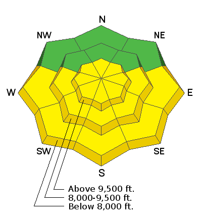
The danger will rise to MODERATE for wet avalanches on steep east to south to west facing slopes today. Both natural and human triggered slides are likely. Areas of MODERATE danger exist primarily in the upper elevations for lingering wind slab and new snow instabilities. Caution should be observed in steep terrain.
Low
Moderate
Considerable
High
Extreme
Learn how to read the forecast here
Special Announcements
The Avalanche Research Program at Simon Fraser University is conducting an online survey to examine how people use avalanche safety information. They want to hear from all backcountry users to understand how they process information provided in public avalanche forecasts. Anyone who completes the survey before May 15th will be entered to win cash prizes.
Weather and Snow
Skies are clear with light northwest winds and temps in the upper teens to low 20s. Yesterday perhaps a trace fell but 48 hour snow totals are 3-5 inches of snow (.1-.34 inches of water). For today, we'll have sunny skies, light winds backing to the southwest and temps rising to the mid-40s at the mid-elevations.
Recent Avalanches
Yesterday, there were no new reports of avalanches in the Provo area. In the Central Wasatch, there were over 30 reported human triggered slides 10-16" deep and up to 200' wide. Most were running on last week's thermal crust or within the new snow. Collapsing and cracking was noted in some steep terrain there.
Ad
Avalanche Problem #1
Wet Snow
Type
Location
Likelihood
Size
Description
Despite cool morning temperatures, the storm snow will heat up in a hurry with direct sun and temps warming to the mid 40s at the mid-elevations, the mid-30s up high. 3-5" of cold snow will become damp and then wet and unstable, running fast and far on last week's suncrusts. Natural and human triggered avalanches will be likely during the heat of the day. Both wet sluffs and wet slabs are possible. When the snow starts becoming damp, move to a cooler slope or lower angle terrain.
Avalanche Problem #2
New Snow
Type
Location
Likelihood
Size
Description
Shallow new snow and pockets of wind slab may be found primarily in the upper elevations. These may be up to a foot in heavily wind drifted terrain. I don't expect the Provo mountains to be as active as the Salt Lake mountains today, but caution should be exercised in steep terrain with safe travel protocols required. Assess each slope carefully and identify features of concern.
Additional Information
Information on outdoor recreation - The State of Utah created this webpage with information about recreating on both state and federal public lands during the current health crisis.

Skiing and riding at closed ski resorts - Some resorts allow access now, and some do not. Please check HERE for the latest info on ski area access.

New to the backcountry (including riding at closed resorts) - Watch the award-winning, 15 minute Know Before You Go video, or take the 5-part, free online-learning series.
General Announcements
This information does not apply to developed ski areas or highways where avalanche control is normally done. This forecast is from the U.S.D.A. Forest Service, which is solely responsible for its content. This forecast describes general avalanche conditions and local variations always occur.