Join us at our 2nd Annual Blizzard Ball

Forecast for the Provo Area Mountains

Nikki Champion
Issued by Nikki Champion on
Tuesday morning, April 13, 2021
The avalanche danger is LOW and, avalanche conditions are generally safe. Watch for unstable snow on isolated terrain features. Natural and human-triggered avalanches are unlikely. However, small avalanches can happen in areas of extreme terrain.
It's springtime, and the weather can change rapidly. With new snowfall on the horizon, pay attention to changing conditions and be ready to alter your plans based on what you observe in your travels.
Low
Moderate
Considerable
High
Extreme
Learn how to read the forecast here
Special Announcements
Sunday, April 18th will be the 163rd avalanche forecast and the last one for the 2020/2021 season. For the rest of the month of April, we will provide updates on the snow and weather anytime it snows which is hopefully a lot. We will also continue to post observations.
Weather and Snow
This morning, skies are clear and the overnight temperatures provided a significant re-freeze. Currently, mountain temperatures range in the mid-20s °F. The winds have transitioned to the east and are currently blowing at speeds of 5-20 mph, with gusts up to 30 mph at the highest elevations.
Today, a slow-moving upper-level system will bring unsettled conditions starting this afternoon and continue through most of the week. This will bring mostly cloudy skies today, and temperatures in the upper 40s °F. The northeasterly winds will remain light throughout the day, averaging at speeds of 10-20 mph with gusts up to 35 mph at the highest elevations.

We could pick up a trace amount of snow throughout the day as the low pressure moves over the area, but it isn't until tonight that we begin to see a drastic change in weather patterns. The measurable precipitation will begin this evening, accompanied by elevated winds. Expect a trace amount to 2" of new snow by the morning, and overnight winds gusting up to 60 mph. This system will be slow-moving and spring-like, so precipitation accumulations will be somewhat convectively oriented. We are still looking at snow totals anywhere between 3-8" by April 16th.
Recent Avalanches
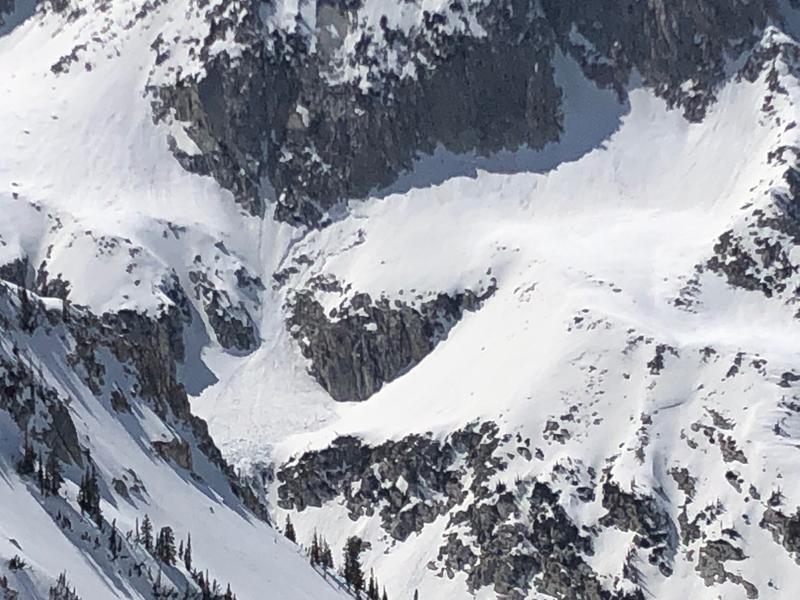
No new avalanches reported in the Provo area backcountry. One new report of an avalanche in the backcountry. In Hogum Fork, of Little Cottonwood Canyon a wet slab avalanche was observed. This avalanche was about 150' wide and ran 400', failing on wet grains within the snowpack.
Photo of the wet avalanche observed yesterday (PC: J. Mletschnig)

As always, find all of our observations and recent avalanches HERE.
Ad
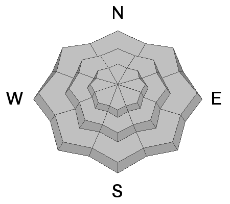
Avalanche Problem #1
Normal Caution
Type
Location
Likelihood
Size
Description
Avalanche conditions in the backcountry are generally safe, keep in mind:
1. Warm temperatures today may produce wet snow avalanches. Primarily small, wet loose avalanches on aspects facing east, south, and west, as well as low and mid-elevation northerly aspects. Wet slab avalanches are also a concern today. Yesterday, a wet slab avalanche was reported in Hogum Fork. While wet slabs are a bit more unpredictable - they can produce much larger destructive avalanches. For both types of wet snow avalanches, look for the obvious signs: Roller-balls and pinwheels cascading down the slope will be the first sign that the snow is becoming wet and unstable, and it's time to get out of there.
2. Strong winds from the past few days may have created isolated pockets of wind drifts at mid and upper elevation northerly terrain. Although these drifts should be small, you want to avoid getting caught in one in steep, consequential terrain.
3. With the snow surface frozen solid this morning, slide for life conditions do exist. Falling on a long sustained steep slope could be very dangerous. An ice axe, crampons, whippet, and the ability to self-arrest - are great tools to have if travelling on these firm surfaces.
Pay attention to changing conditions, any periods of increased snowfall will lead to increased avalanche danger. Remember that even a small avalanche can be problematic in very steep and complicated terrain.
Avalanche Problem #2
Gliding Snow
Type
Location
Likelihood
Size
Description
The glide avalanche in Broads Fork last Wednesday and Friday is a good reminder this avalanche problem will be a threat for the rest of the spring. It's best to avoid terrain with steep, smooth rock features or terrain that is very grassy and smooth underneath the winter snowpack. Places like Broads Fork and Stairs Gulch are best to avoid this time of year as at any moment; a full depth avalanche can release on these smooth rock slabs.
General Announcements
Please visit this website with information about Responsible Winter Recreation by the Utah Office of Outdoor Recreation.

This information does not apply to developed ski areas or highways where avalanche control is normally done. This forecast is from the U.S.D.A. Forest Service, which is solely responsible for its content. This forecast describes general avalanche conditions and local variations always occur.