Forecast for the Provo Area Mountains

Nikki Champion
Issued by Nikki Champion on
Wednesday morning, April 1, 2020
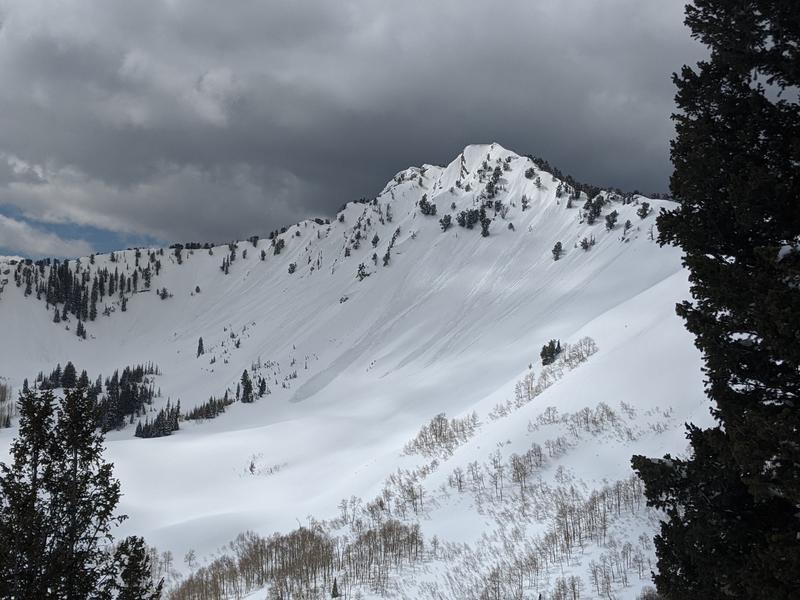
Today, the overall avalanche danger is MODERATE. Another day of warm temperatures and partly cloudy skies will cause wet-loose avalanches to develop on all elevation solar slopes and low and mid-elevation northerly slopes during the heat of the day.
At the upper elevations, fresh slabs of wind drifted snow up to 3 feet deep may still exist. Look for any signs of wind drifted snow, and avoid those slopes

Pay attention to changing springtime conditions and evaluate terrain carefully.
Low
Moderate
Considerable
High
Extreme
Learn how to read the forecast here
Special Announcements
Spring Awareness Campaign - Help us save lives through avalanche forecasts and education. Consider making a donation before April 8th.

Information on outdoor recreation - The State of Utah created this webpage with information about recreating on both state and federal public lands during the current health crisis.

January 5, 2019 - Read this collection of 6 stories and a podcast about that day with a low avalanche danger, 8 skier triggered avalanches, four catch and carries...a partial and critical burial, and a trip to the emergency room.
Weather and Snow
This morning, mountain temperatures are in the low 40s F at trailheads and upper 30s F at ridgelines. Winds are still elevated and currently west southwesterly blowing 10-15 mph, with gusts above 20 mph at mid-elevations. At upper elevations, the winds are averaging 20 mph with gusts near 35 mph.
Today, a slow-moving cold front will bring another chance of light snow or rain showers and partly cloudy skies to the area. Mountain temperatures will be in the mid-40s and low 50s F, Winds will become more westerly, averaging 20-30 mph at mid-elevations, and 30-40 mph at upper elevations with gusts reaching up to 55 mph.
The next round of precipitation should begin tonight and could bring either rain or snow to the Provo area mountains.
Recent Avalanches
No new avalanches reported in the Provo area backcountry yesterday.
Check out all the recent slides HERE.
Ad
Avalanche Problem #1
Wet Snow
Type
Location
Likelihood
Size
Description
There is still a lot of new snow on all slopes in the backcountry and once warm temperatures and sun hit this new snow, it immediately becomes wet and begins to produce wet avalanche activity. When I was traveling on the Park City Ridgeline, yesterday, I saw many small wet-loose avalanches and rollerballs on all aspects as soon as the sun came out.
Another day with warm temperatures, broken skies, and potentially rain will quickly cause the snow on all aspects and elevations to become warm and wet. Natural and human triggered loose wet sloughs will become likely as the slopes warm. These usually start at your feet and fan out below you. HOWEVER, watch out for these slides happening naturally especially if you are in a gully or any confined terrain where a small one could pile up deeply. Look for signs of wet snow like rollerballs.
Photo of wet activity on Mt. Raymond yesterday, in the Central Wasatch - point releases and roller balls are a sign of wet snow. (Photo: Manship)
Avalanche Problem #2
Wind Drifted Snow
Type
Location
Likelihood
Size
Description
Elevated winds from the Southwest yesterday into this morning may have transported some dry snow and created small pockets of recent-wind drifted snow in isolated upper-elevation terrain features, such as ridgelines and cross-loaded gullies. These drifts may be up to 3 feet deep and 100 feet wide and reactive to cornice drops and ski cuts. Avoid terrain features with any obvious signs of wind-drifted snow.

Pay attention to cornices: Many ridgelines now have overhanging cornices, and yesterday there were a few reports of cornice triggered wind slabs. A few days of strong winds at the uppermost ridgelines have made cornices even larger. Be sure to give cornices a wide berth as they typically break much further back than expected.
Additional Information
Skiing and riding at closed ski resorts - Some resorts allow access now, and some do not. Please check HERE for the latest info on ski area access.
New to the backcountry (including riding at closed resorts) - Watch the award-winning, 15 minute Know Before You Go video, or take the 5-part, free online-learning series.
General Announcements
This information does not apply to developed ski areas or highways where avalanche control is normally done. This forecast is from the U.S.D.A. Forest Service, which is solely responsible for its content. This forecast describes general avalanche conditions and local variations always occur.