Skies are partly cloudy with a quick hitting storm on the horizon. Ahead of the storm, mountain temperatures are in the upper 20s to low 30s. Winds backed to the southwest overnight and are blowing 20mph with gusts to 35. Gusts exceed 60mph along the highest ridgelines. Snowfall should begin mid-morning with 3-6" expected by evening. Clearing for tomorrow with another storm slated for Tuesday night into Wednesday.
For today, we'll see snow, heavy at times, with temperatures dropping to the upper teens and low 20s. Winds will veer to the west northwest post frontal and remain breezy, blowing 20mph with gusts to 40.
Greg Gagne's Week in Review is published and can be found
HERE.
Explosive testing along the Cascade ridgeline south of Provo canyon Friday produced two large avalanches on steep northeast aspects above 10,000'. Multiple collapses were noted.
In the central Wasatch....
In
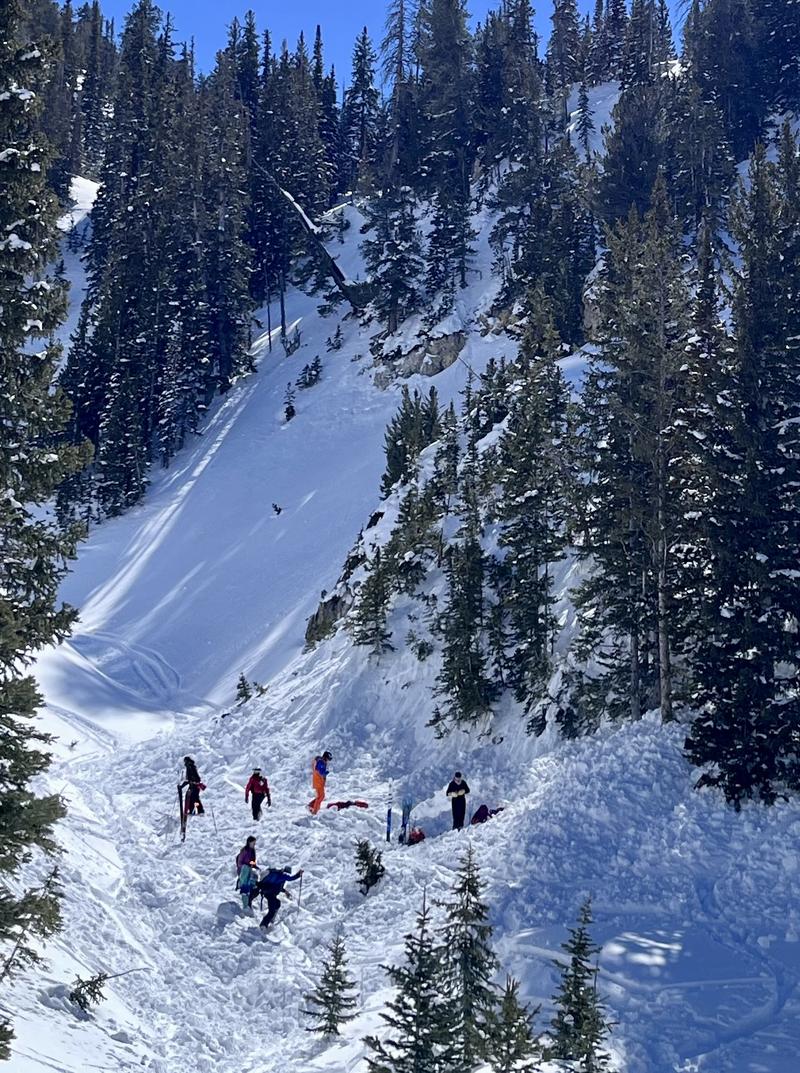
Silver Fork of BCC, a skier was caught, carried, and fully buried six feet deep for over 20 minutes yesterday. Thanks to the rescue efforts of his party, he was recovered breathing but unconscious and later flown to a hospital in town as in "stable, but critical condition". Our preliminary report is
HERE>. Thanks to the efforts of SL County SAR, WBR, Solitude and Snowbird ski patrol teams, Powderbird, Life Flight, and others. The avalanche was on a steep northeast facing slope at 9300'. The avalanche was estimated at 2.5' deep and 150' wide. Photo below.
At roughly the same time, a lone skier just down canyon was caught, carried, and partially buried to his waist in a 20" deep and 125' wide avalanche in Mats Basin. He was carried 300' down the path, lost gear, but was able to get out on his own. The avalanche was on a steep north facing slope at 8800'.
Another party in Silver Fork reported triggering a soft slab on their exit from West Bowl. The slide was estimated 6"-3' deep on a steep north facing rollover at 9400'.
Further down BCC in Mineral Fork, a party unintentionally triggered a 2' deep and 70' wide soft slab while descending East Mineral. This avalanche was on a north facing pitch at 10,200'.
Last, but not least, Park City ski patrol noted that Scott Peak (a slope out of bounds to the north) ran naturally 2-3' deep and 800' wide. This avalanche is a repeater, having avalanched in January. This is a steep wind-loaded slope, overhung with cornices. It faces northeast at 9700' there along the PC ridgeline.
The only significant wet avalanche activity was reported cascading over the Hellgate cliffs in LCC.
ALL of these can be found in Observations and Avalanches in the Menu above.


