Join us at our 2nd Annual Blizzard Ball

Forecast for the Provo Area Mountains

Nikki Champion
Issued by Nikki Champion on
Friday morning, March 12, 2021
The avalanche danger is LOW. Watch for unstable snow on isolated terrain features. Remember that risk is inherent in mountain travel.
The new snow will likely lead to shallow soft slab avalanches or minor sluffing on the steepest slopes today. Falling in steep terrain and being unable to stop on hard, refrozen snow underneath the new snow remains a hazard.
Pay attention to changing conditions, periods of increased snowfall will lead to increased avalanche danger.
Low
Moderate
Considerable
High
Extreme
Learn how to read the forecast here
Weather and Snow
This morning, skies are broken and mountain temperatures are in the mid-teens F. A trace amount of snow, under 1 inch, fell overnight. The east, northeasterly winds remain very light only gusting near 20 mph at upper elevations.
Today, another 1-3 inches of snow could fall. Winds will remain light and temperatures should warm into the mid-30s F. Spring weather can be quite exciting and brief periods of heavy snowfall with a chance of lightning could occur late this morning into the early afternoon.
Total snow amounts are between 2-4" since Wednesday. Following the initial new snow on Wednesday, the sun came out and made the new snow damp on the east, south, and west aspects causing those aspects to refreeze into a firm riding surface before yesterday's new snow. Overall, riding conditions have improved greatly. On the solar aspects, you can feel the firm surface from Wednesday beneath the new snow, in more protected areas you will find the best riding.
Our Week in Review - where we highlight significant avalanche and weather events from the past week has been published.
Recent Avalanches
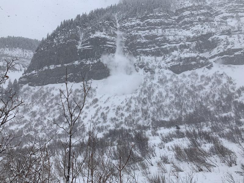
Yesterday there were a few small, loose avalanches in the new snow. A few of these new snow avalanches were reported in the Aspen Grove area, and likely occurred during the highest snowfall rates. Between 1:00 PM - 4:00 PM.
Photo of a new snow avalanche that occurred on Robert's Horn (PC: R. Turville)

Read what people are finding under Observations and Avalanches.
Ad
Avalanche Problem #1
Normal Caution
Type
Location
Likelihood
Size
Description
Today, the overall avalanche danger is LOW. This means that human-triggered avalanches are unlikely, but small avalanches in isolated areas are possible.
Today I would watch for:
New Snow: Since Wednesday 2-4 inches of light snow has fallen on an array of firm snow surfaces in the backcountry, and I would expect to continue seeing shallow new snow avalanches today. The primary concern will be fast running sluffs in steep terrain, these may run naturally if there are any periods of heavy snowfall this afternoon. Any area that still held any lingering soft snow, before yesterday, will be suspect for some shallow soft slabs to form. Remember that even a small avalanche can be problematic in very steep and complicated terrain. Think about the terrain you are traveling above today.
Slide-for-life: The new snow could easily be scoured off steep slopes and expose the firm icy slopes below. Hard icy conditions aren't an avalanche concern, but a hazard nonetheless in steep terrain where you wouldn't be able to stop if you fell.
General Announcements
Please visit this website with information about Responsible Winter Recreation by the Utah Office of Outdoor Recreation.

This information does not apply to developed ski areas or highways where avalanche control is normally done. This forecast is from the U.S.D.A. Forest Service, which is solely responsible for its content. This forecast describes general avalanche conditions and local variations always occur.