Join us at our 2nd Annual Blizzard Ball

Forecast for the Provo Area Mountains

Mark Staples
Issued by Mark Staples on
Wednesday morning, March 10, 2021
Overall today, the avalanche danger is LOW. Watch for shallow, soft slabs of wind drifted snow that could produce small avalanches underneath upper elevation ridgelines

The greatest hazard is falling in steep terrain and being unable to stop on the hard, refrozen snow underneath this morning's few inches of new snow.
Low
Moderate
Considerable
High
Extreme
Learn how to read the forecast here
Weather and Snow
Since yesterday 1-2 inches of snow fell. Temperatures this morning are generally in the upper teens and low 20s F. Westerly winds are blowing 5-10 mph gusting to 15 mph. At the highest elevations, winds are blowing 25 mph and gusting 40 mph.
Today another inch of snow may fall in the morning, and the sun should appear this afternoon with some lingering clouds. Temperatures at low elevations may reach the low 30s degrees F while most other places will have temperatures in the 20s F. Winds will continue from the west 5-15 mph.
A few more inches of snow could fall tonight or tomorrow morning followed by a few more inches on Friday. After warm weather last weekend that made the snow surface wet, it is now refrozen with just a few inches of snow on top. No major snowfall is in the forecast. Hopefully, a few inches falling here and there may start to add up by this weekend to improve the riding.
Recent Avalanches
No new avalanche activity was reported yesterday. As always, you can find more details in the Observations and Avalanches tab on our website.
Ad
Avalanche Problem #1
Wind Drifted Snow
Type
Location
Likelihood
Size
Description
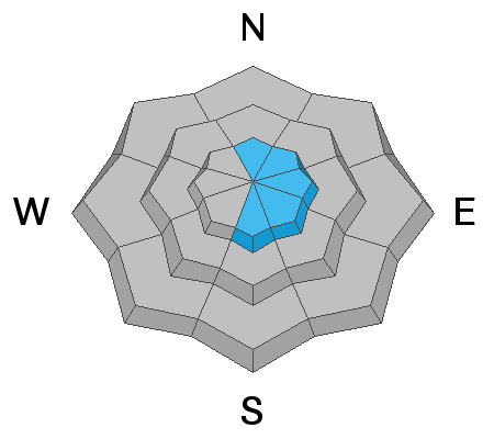
A few inches of new snow at upper elevations combined westerly winds should create some soft slabs of wind drifted snow at upper elevation ridgelines. These wind slabs will be shallow and could produce small avalanches. With firm refrozen snow underneath the new snow, triggering a small wind slab could cause you to take a long fall down a slope.
General Announcements
Please visit this website with information about Responsible Winter Recreation by the Utah Office of Outdoor Recreation.

This information does not apply to developed ski areas or highways where avalanche control is normally done. This forecast is from the U.S.D.A. Forest Service, which is solely responsible for its content. This forecast describes general avalanche conditions and local variations always occur.