Join us at our 2nd Annual Blizzard Ball

Forecast for the Provo Area Mountains

Drew Hardesty
Issued by Drew Hardesty on
Saturday morning, February 20, 2021
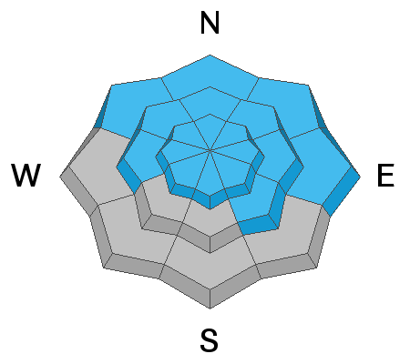
A CONSIDERABLE avalanche danger exists on many slopes at the mid and upper elevations. Considerable means that human triggered avalanches are likely.
The danger is more prevalent on west to north to southeast facing slopes and on any freshly wind drifted terrain.
Any avalanche you trigger may step down into deeply-buried weak layers, creating very large and destructive avalanches.

All the experienced backcountry riders I know are setting wide margins of safety and continue to rule out steep terrain for now.
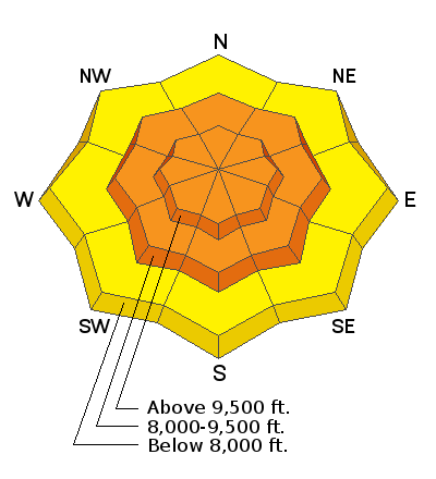
Low
Moderate
Considerable
High
Extreme
Learn how to read the forecast here
Special Announcements
On Monday, February 22, at 7 PM, the UAC will livestream a one hour review and debrief of the tragic Wilson Glades avalanche accident, followed by a Q & A period. The link for registration is HERE.
A good primer for this will be to listen in to yesterday's RadioWest conversation about avalanches and the incident. Stream it here or wherever you get your favorite podcasts.
Weather and Snow
Another storm is here. Good radar returns highlight the early morning snowfall in the Ogden mountains. Snowfall should begin this morning and add a couple inches of new on top of yesterday's 2-4".
Current mountain temperatures are in the low to mid 20s. Winds have been from the southwest, blowing 25-30mph.
With the arrival of the cold front, temperatures will drop back down to the low teens. Winds will shift to the northwest with hourly wind speeds averaging 20-30mph.
We get a bit of a break Sunday and Monday with the next disturbances moving through Tuesday and possibly again Thursday night. You'll get whiplash just watching the temperatures this week.
Recent Avalanches
It is worth mentioning that we in particular and the West in general are not out of the woods yet: We've suffered 22 avalanche fatalities in 21 days in the West, the most recent in Idaho and Wyoming. Utah is up to 6 avalanche fatalities for the season.
Conditions remain dangerous in many areas.
We did not hear of any avalanches in the Provo mountains yesterday.
Ad
Avalanche Problem #1
Persistent Weak Layer
Type
Location
Likelihood
Size
Description
In the past week, we have added 2-3 feet of snow containing nearly 3 inches of water to a still-suspect basal snowpack in the Provo-area mountains. Although it may be a little bit harder to trigger an avalanche failing in these deeply-buried weak layers, any avalanche you trigger will be very large and destructive - 4-6' deep and hundreds of feet wide. Or even larger.
Additional wind and snow will stress and already stressed snowpack in the mid and upper elevations. Remember that any new snow avalanche or large cornice failure may step into older weaker layering, resulting in a much larger avalanche.
Previous tracks on the slope are zero signs of stability. Many avalanches have taken out previous tracks.
Avalanche Problem #2
Wind Drifted Snow
Type
Location
Likelihood
Size
Description
Winds have increased during the overnight hours and will persist into today. These winds will have plenty of fresh snow available for transport, and fresh wind drifts and likely at the mid - and especially upper - elevations. Although you are more likely to find fresh drifts on the leeward aspects facing north through southeast, terrain may channel and funnel winds, with wind drifts possible on any aspect. Watch for signs of sensitive wind drifted snow such as cracking.
Additional Information
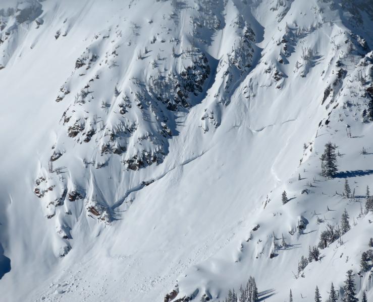
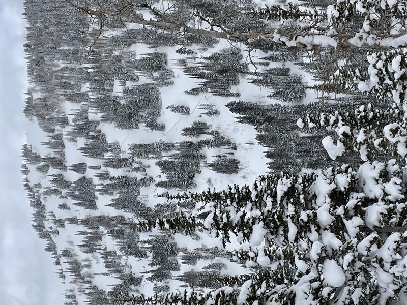
These are two examples of avalanches from the recent avalanche cycle. They are from the central Wasatch, but I want to give an example. The first is upper elevation, east facing and open terrain. The second is mid-elevation, west facing, and more interspersed with trees. Quite different from one another, but they are both avalanche terrain. Both could kill you. Slope angle is the great equalizer right now.
pc: Bill Nalli
pc: Mitch Potter
General Announcements
Please visit this website with information about Responsible Winter Recreation by the Utah Office of Outdoor Recreation.

This information does not apply to developed ski areas or highways where avalanche control is normally done. This forecast is from the U.S.D.A. Forest Service, which is solely responsible for its content. This forecast describes general avalanche conditions and local variations always occur.