Forecast for the Provo Area Mountains

Drew Hardesty
Issued by Drew Hardesty on
Saturday morning, December 7, 2019
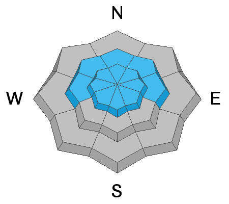
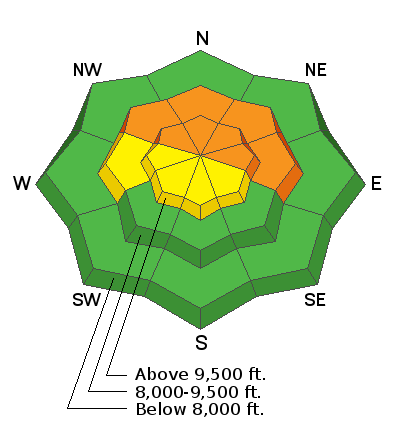
Areas of CONSIDERABLE danger exist on mid and upper elevation aspects facing northwest, through north, and east where a persistent weak layer of snow buried down 2-3' exists. A MODERATE hazard exists at the upper elevations for fresh wind drifts in steep lee terrain.
Low
Moderate
Considerable
High
Extreme
Learn how to read the forecast here
Special Announcements
Thanks to the generous support of our Utah ski resorts and Ski Utah, we have discount lift tickets available. All proceeds from these go towards paying for avalanche forecasting and education! Get your tickets HERE.

Get one of these cool t-shirts to support the UAC and other avalanche centers across the U.S. INFO
Weather and Snow
Skies are clear with mountain temps in the mid to upper 30s. Winds are southerly, blowing 15-20mph. The highest ridglines likely have wind speeds in the 30+mph range with gusts to 60.
Snow depths in the Provo mountains are 1-2'.

Clouds will increase today and we should start to see some light snowfall overnight with storm totals through early Monday pegged at 5-10". Mountain temps will be in the upper 20s and near 30°F today with moderate south/southwest winds. Clearing expected Monday eve through Wednesday with generally unsettled weather the latter part of the work week.
Recent Avalanches
None.
Ad
Avalanche Problem #1
Persistent Weak Layer
Type
Location
Likelihood
Size
Description
We've had no reports from the upper elevations of the Provo area mountains but extrapolate that mid and upper elevation snow structure is poor and potentially unstable on steep northwest to easterly facing slopes. The Thanksgiving storms are now a thick slab overlying weak old snow from October and this structure continue to cause avalanches in the Salt lake mountains. Extra caution is warranted in steep shady terrain.
The video below (link) further illustrates our primary avalanche problem.
It will take patience while allowing time for this layer to heal, and this layer may become increasingly active later this weekend with an additional load of snow and wind. Remember, existing tracks on a slope are zero indication of stability. For now, I am avoiding all steep northerly aspects.
Avalanche Problem #2
Wind Drifted Snow
Type
Location
Likelihood
Size
Description
Shallow but sensitive drifts may be found in lee terrain today owing to the overnight and this morning southerly winds. Shooting cracks give tell-tale signs of instability. Avoid smooth or rounded deposits of wind drifted snow.
Additional Information
With sun and warming, shallow wet push-alanches and rollerballs are likely on steep sunny slopes.
Consider signing up for a companion rescue course!