AVALANCHE WARNING!! Tap for info

Forecast for the Provo Area Mountains

Dave Kelly
Issued by Dave Kelly on
Tuesday morning, December 17, 2024
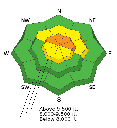
Today, there is a CONSIDERABLE avalanche danger on upper elevation northwest-north-east facing aspects for triggering a wind-drifted snow avalanche failing on buried facets. These avalanches could be 2'-3' deep and up to 100' wide running up to 500' vertical.
There is a MODERATE avalanche danger on upper elevation west-south-southeast aspects and mid elevation northwest-north-east facing terrain. The avalanche danger is LOW on all other aspects.
The biggest hazard for today is triggering a wind slab that fails on weak faceted snow. Cautious route finding and conservative decision making is essential.
Low
Moderate
Considerable
High
Extreme
Learn how to read the forecast here
Weather and Snow
This morning, under partly cloudy skies temperatures are in the mid 30's °F. Winds are calm at the lower elevations and blowing from the southwest in the mid 20's gusting to the 30's MPH at the higher elevation weather stations. There was no new snow reported overnight.
For today, look for partly cloudy skies with temperatures 36-42 °F and winds blowing from the west-northwest 5 gusting to 10 MPH at the 9,000' ridgelines and 30 gusting to 40 MPH at the 11,000' ridgelines. There is a trace of snow forecast today.
Yesterday, Drew reported sinking through to the ground with skis on. This is a surefire sign of weak snow and in higher elevations where the wind has overloaded this weak snow the avalanche danger is higher.
With temperatures at many weather stations hovering at or above freezing for the last twelve hours and forecasted to remain above freezing, you may find areas of damp snow and may see rollerballs or wet loose activity in steep rocky features in lower elevation terrain.
Recent Avalanches
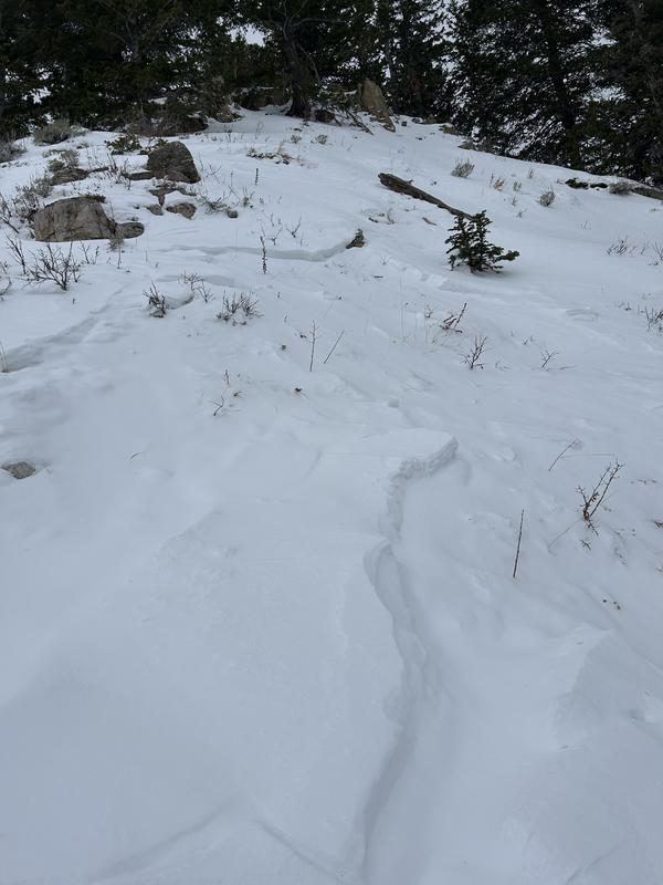
Yesterday, Drew (photo below) reported an avalanche that most likely occurred Sunday in the UFO Bowls outside of Aspen Grove. This 10" deep avalanche was likely triggered by an animal and failed on weak faceted snow.
Ad
Avalanche Problem #1
Persistent Weak Layer
Type
Location
Likelihood
Size
Description
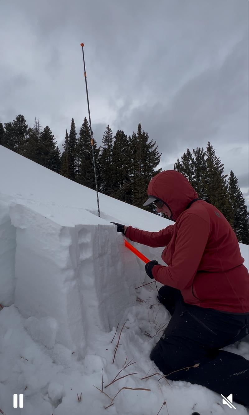
We now have two buried weak layers in our immature snowpack. One is a layer of facets located 1"-8" off the ground and the other is a buried surface weakness that formed during the early December high pressure and is just under the newest snow. The one near the ground is easy to see in snowpits and is the classic weak snow with strong snow over the top.
The harder to find surface weakness is now buried 6"-12" under the most recent new snow and wind. This weak snow will be spotty as it may have been destroyed by high winds and warm temperatures before it was buried by the most recent storm snow.
Photo (M. Rossberg) of weak snow from Ant Knolls
Avalanche Problem #2
Wind Drifted Snow
Type
Location
Likelihood
Size
Description
Sustained strong winds have loaded snow in mid and upper elevation terrain, these recently formed wind slabs may be supportive enough to allow you to get further onto the slope before they break, making them all the more dangerous. Read more about wind loading HERE.
General Announcements
This information does not apply to developed ski areas or highways where avalanche control is normally done. This forecast is from the U.S.D.A. Forest Service, which is solely responsible for its content. This forecast describes general avalanche conditions and local variations always occur.