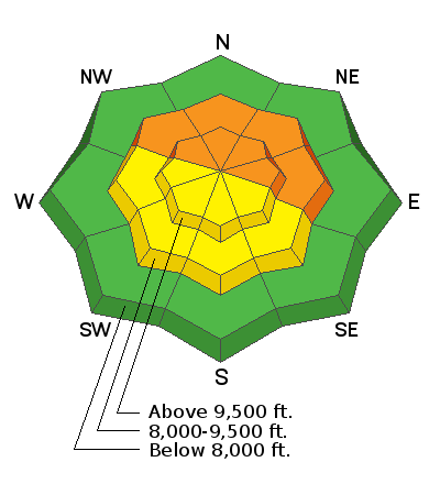
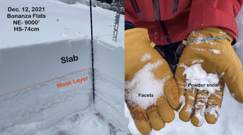
Heads Up: this week, we have an active weather pattern with plenty of wind and new snow in the weather forecast. This wind and new snow will overload buried weak layers, creating dangerous avalanche conditions over the next few days (read more below).
Currently, the skies are clear, and the upper elevation mountain temperatures are 22-28 °F above about 8,000'. Winds continue to crank across the upper elevation ridgelines blowing from the south with speeds of 25-35 mph, gusting into the 50's and 60's. Yesterday afternoon, Hidden Peak (11,000') recorded a wind gust at 103 mph. Speeds of 96-110 mph define a category two hurricane. Impressive!
Today, we can expect increasing clouds and temperatures climbing into the upper 20's to the low 30's °F at about 8,500' in elevation. As a large-scale storm approaches Northern Utah, the southerly winds will remain strong, with speeds in the 25-35 mph range for much of the day. We could see gusts at the highest elevations hitting the triple digits again.
It's a one-two punch, with the first storm starting this evening around the dinner hour. The southerly winds finally back to the west and slow in speed as the front crosses overhead around 11:00 pm. By Wednesday morning, we could see 10"-15" of new snow (0.80"-1.0" water). A brief lull throughout the day on Wednesday will allow the second wave to move in later in the evening, lasting into Friday with another 5"-8" of new snow (0.40"-0.60" water). In total, we could see anywhere from 15"-25" inches of new snow over the next couple of days.
Video: Loop of the 500 millibar height / 500 millibar Vorticity showing both storms impacting Northern Utah with a precip total at the end.
Yesterday one avalanche was reported from the Backcountry along the Park City Ridgeline in
No Name Bowl. This avalanche was remotely triggered (from a distance) and was roughly 2' deep 400' wide and ran into the flats breaking a few small trees. You can find all backcountry observations
HERE. 


