Forecast for the Provo Area Mountains

Issued by Nikki Champion on
Tuesday morning, November 12, 2024
Tuesday morning, November 12, 2024
Welcome to the start of the 2024-2025 winter season!
High-elevation, shady aspects with lingering old snow present the highest avalanche risk. Any new snow may not bond well to slick crusts or weak, sugary faceted layers, potentially creating sensitive slabs, particularly in steep, wind-drifted terrain. Practice safe travel techniques: travel with a partner and carry essential rescue gear, including a transceiver, probe, and shovel.
Remember the saying: If there’s enough snow to ski or ride, there’s enough snow to slide.
Although burial risk is generally low, the primary danger lies in being swept through consequential terrain. It’s early in the season with limited options for skiing and riding, so please exercise caution.
This forecast was updated at 8:00 a.m. on November 12, 2024. Updates will follow as conditions warrant.

Low
Moderate
Considerable
High
Extreme
Learn how to read the forecast here
 Special Announcements
The 17th Annual Utah Snow and Avalanche Workshop (USAW) is scheduled for Saturday December 7th - Information and tickets available here.
 Weather and Snow
A fast-moving storm will sweep through the area today, with a cold front currently moving across northern Utah. Heavy snow is possible this morning, transitioning to more scattered, showery snowfall in the afternoon and evening. Winds will shift from southwesterly to breezy west-northwest behind the front.
As of 7 a.m., the rain/snow line sits around 7,000', with 1" of snow reported across the Provo area. Mountain temperatures are in the mid-to-upper 20s, with west winds blowing at 20 mph and gusting to 35 mph, while the highest elevations are gusting up to 40 mph.
Today, expect rain and snowfall to peak in the morning, with showers and flurries continuing through early afternoon. Snow totals could still reach 4-8" throughout the Provo area mountains. The rain/snow line is expected to gradually drop to around 5,000'. The next storm arrives this weekend, bringing another solid round of snow.
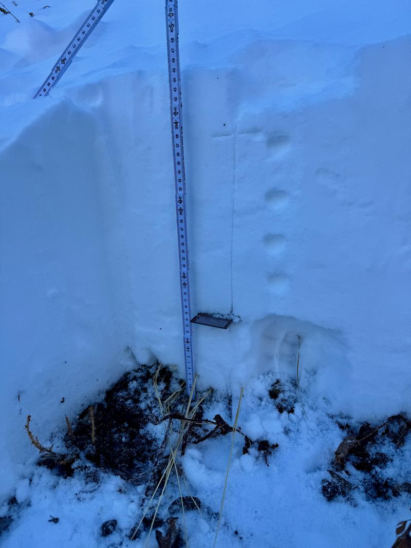
Before this storm, snow depths ranged from 6"-18" above 8,500', with some isolated upper-elevation ridges nearing 2'. With the low sun angle, cold temperatures, and clear skies, observers have noted that the thin snowpack is starting to facet. While this isn’t a problem when the snow is at the surface, keep in mind this existing snow could become a weak layer down the line once it gets buried.
In the below photo forecaster Dave Kelly gives us a rundown of what the snowpack is looking like in the Provo area mountains.
A thin early-season snowpack can change quickly, especially on cold, shaded north aspects where strong temperature gradients speed up faceting. Read more about faceting in the snowpack HERE. Recent Avalanches
There were reports of shallow dry loose avalanches in steep terrain over the last few days. Find all recent observations HERE.
Avalanche Problem #1
Normal Caution
Type
Location

Likelihood
Size
Description
Avalanche conditions are generally safe, but keep the following in mind:
- New Snow - The new snow may not bond well to the different crusts and weak snow surfaces. There will be a potential for sluffing and even shallow soft slabs of storm snow, especially during any period of higher precipitation.
- Wind-Drifted Snow - The westerly winds may find some soft snow to drift at the upper elevations. Watch for signs such as cracking in fresh wind slabs. Although these drifts should be small, you want to avoid getting caught in one in steep, consequential terrain.
Additional Information
It’s never too early to start thinking about avalanches. Here are a few things to consider doing:
- Before traveling within one of the ski resort boundaries, even early season, check out Resort Uphill Policies
- We have over 5 hours of free online learning at the Know Before You Go Website
- Sign up for an on-snow class or in in person Know Before you Go Event HERE
- Get your avalanche rescue gear ready for winter. Put fresh batteries in your transceiver and update the firmware. Inspect your shovel and probe. Get your airbag backpack ready by possibly doing a test deployment and updating the firmware if it is an electric version or getting your canister refilled if it's not electronic


