Join us at our 2nd Annual Blizzard Ball

Forecast for the Provo Area Mountains

Drew Hardesty
Issued by Drew Hardesty on
Thursday morning, January 21, 2021
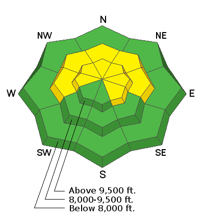
Areas of MODERATE danger exist on many slopes at the mid and upper elevations. Human-triggered avalanches remain possible, particularly where there has been recent wind loading.
Lingering hard and soft wind slabs may still be triggered in isolated terrain of the alpine. Remember that consequences are amplified in unforgiving terrain.
The avalanche danger will be on the rise Friday into the weekend.
Low
Moderate
Considerable
High
Extreme
Learn how to read the forecast here
Special Announcements
Thanks to the generous support of our local resorts, Ski Utah, and Backcountry, discount lift tickets are now available.
Support the UAC while you ski at the resorts this season. Tickets are available here.
Weather and Snow
Skies are partly cloudy.
Mountain temperatures are in the upper 20s. Winds are from the southwest, blowing 10-15mph. 11k winds are 15-20mph with gusts to 30.
We do have a storm on the horizon, although so many of them this winter have looked promising from afar, only to fade into nothingness upon approach. Like a mirage.
We'll see.
Winds will increase from the southwest tomorrow and snowfall should begin in the midday hours. Snowfall should be heavy at times, lasting through the night, and continuing off and on through Saturday. Most of the snowfall will be ushered in on this southwest flow regime and densities will be a bit higher - perhaps in the 7-8% zone. Storms from the southwest preferentially favor many areas of the Provo mountains, particularly Sundance. There is still some spread in the forecast snowfall amounts, so I'll hedge and offer up 10-16" by late Saturday.
The Outlook:
Some clearing for Sunday followed by another storm that dives south for early week. Some possibilities of another storm mid/late week.

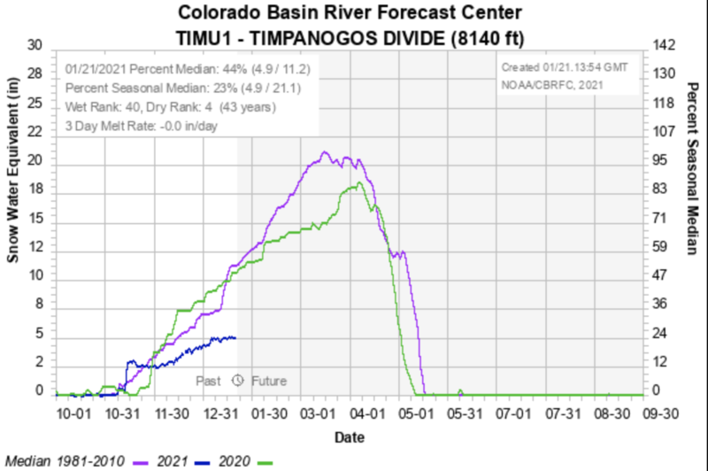
The Timp Divide snotel site shows that winter conditins are less than half of average. See below. What we know is that a thin snowpack is a weak snowpack. This snowpack will easily avalanche with any significant storms. Stay tuned.
Recent Avalanches
None.
Ad
Avalanche Problem #1
Persistent Weak Layer
Type
Location
Likelihood
Size
Description
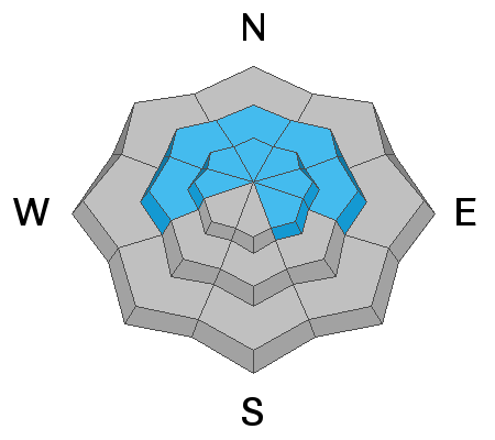
The main problem continues to be the poor snowpack structure that exists throughout the entire Wasatch Range. The problem primarily exists on shady slopes at the mid and upper elevations, where a strong slab of snow can release and fail in the weak faceted snow below. Snowpit results, significantly fewer reports of cracking and collapsing and lack of avalanche activity show that the likelihood of triggering an avalanche is decreasing....however, it is still not zero.
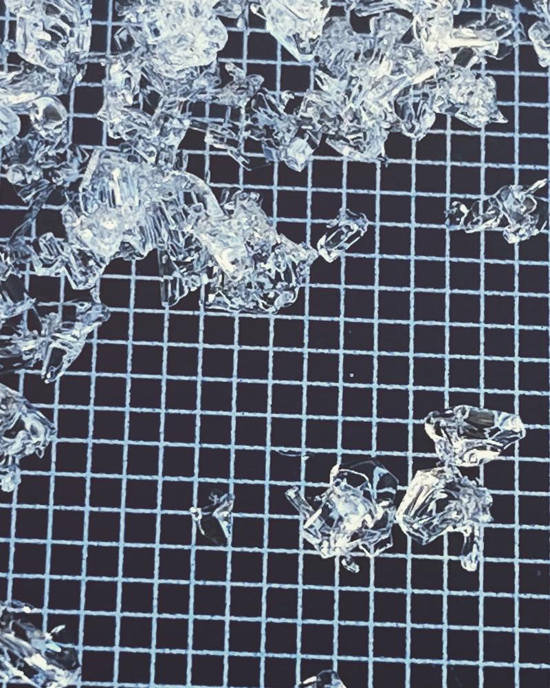
Much of our snowpack is made up of varying sizes of weak sugary snow known as facets...or even depth hoar. They're quite beautiful really - often large, angular, crystaline, cupped, even chained sometimes, but they're also quite dangerous when overloaded by heavy snowfall and/or strong winds. If the storm(s) verify, these will be the players in many of the avalanches we see.
Longtime avalanche pro Jake Hutchinson has a nice photo below.
Additional Information
NOW is the time to again practice your companion rescue skills.
For a primer on backcountry emergencies, click HERE
General Announcements
Please visit this website with information about Responsible Winter Recreation by the Utah Office of Outdoor Recreation.

This information does not apply to developed ski areas or highways where avalanche control is normally done. This forecast is from the U.S.D.A. Forest Service, which is solely responsible for its content. This forecast describes general avalanche conditions and local variations always occur.