Join us at our 2nd Annual Blizzard Ball

Forecast for the Provo Area Mountains

Greg Gagne
Issued by Greg Gagne on
Friday morning, January 17, 2025
The avalanche danger is MODERATE on upper elevation aspects facing northwest through north and east where it is possible to trigger an avalanche failing in a persistent weak layer buried 2-3 feet deep.
The avalanche danger is also MODERATE on all aspects at the upper elevations where there are fresh soft slabs of wind-drifted snow.
All other slopes have a LOW danger.
Low
Moderate
Considerable
High
Extreme
Learn how to read the forecast here
Special Announcements
Join the UAC at Deer Valley on January 30th for the 2nd Annual Blizzard Ball Gala. The night will be full of fun including delicious cuisine, live music, an auction, and presentation by Bruce Tremper.
Weather and Snow
This Morning: Partly cloudy skies with temperatures between 15-25° F. Winds are from the west and have increased overnight, averaging in the teens with gusts in the 20's mph at the mid elevations, with 11,000' winds averaging in the 30's and gusting into the upper 40's mph.
Today: Increasing clouds with temperatures in the upper 20's F. Winds will be from the west/northwest and increasing ahead of a cold front arriving this afternoon, gusting to 30 mph along exposed ridgelines up to 10,000', with gusts over 50 mph at 11,000'.
Overnight and into Saturday: Strong winds this evening with snowfall developing overnight and into Saturday. We are not expecting large water amounts with this storm system (only perhaps 0.20"), but with such cold air in place, snow densities will be quite low which means we may see 2-4" of snowfall by later Saturday.
Recent Avalanches
No recent avalanche activity reported from the Provo mountains, but to our north in the Salt Lake mountains, there was a skier-triggered avalanche failing in the persistent weak layer on Thursday on Pioneer Ridge in upper Big Cottonwood Canyon. This was on north aspect at 10,100' and the avalanche was up to 2 feet deep and 30 feet wide. The rider was caught and carried, but deployed an airbag and stayed on the surface with no injuries. Their thoughtful incident report is a worthy read. (Photo below.)

We've received several excellent observations over the past several days which you can read by clicking the button below.
Ad
Avalanche Problem #1
Persistent Weak Layer
Type
Location
Likelihood
Size
Description
There exists a buried layer of faceted snow and depth hoar 2-4 feet deep at the mid and upper elevations on aspects facing northwest through east. The last reported avalanche failing on this layer was on January 5 on the Ant Knolls. But to our north where there is a similar snowpack structure, avalanches failing on the PWL are being reported almost daily.
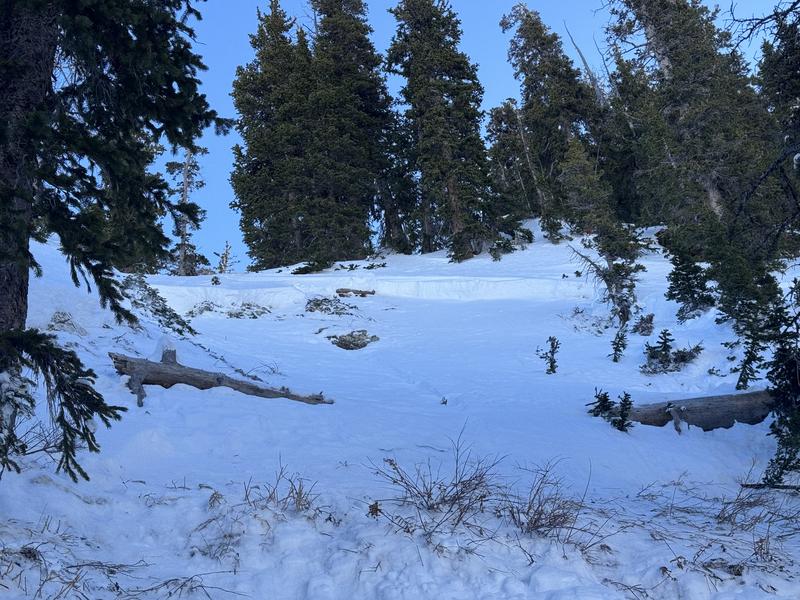
On Thursday, Russ Costa and I traveled to the UFO Bowls where we found a shallow snowpack with poor structure. In the video below, I describe how we handled this situation.
Avalanche Problem #2
Wind Drifted Snow
Type
Location
Likelihood
Size
Description
Westerly winds will create soft slabs of wind-drifted snow on all aspects at the upper elevations. Any fresh wind drifts may be sensitive as they will form on top of slick sun crusts on southerly-facing slopes and weak snow at the surface on shady slopes.
Additional Information
The Data Explorer for avalanches on the PWL since Christmas Eve.
General Announcements
This information does not apply to developed ski areas or highways where avalanche control is normally done. This forecast is from the U.S.D.A. Forest Service, which is solely responsible for its content. This forecast describes general avalanche conditions and local variations always occur.