Check out our Holiday Auction - Sign Up for the Utah Snow and Avalanche Workshop (USAW)

Forecast for the Ogden Area Mountains

Drew Hardesty
Issued by Drew Hardesty on
Monday morning, April 8, 2024
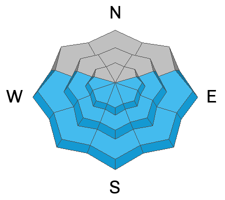
Most terrain has LOW avalanche danger this morning. Isolated areas of MODERATE avalanche danger, however, exist in the upper elevations for pockets of wind drifted snow. These pockets of soft slab will be primarily found on steep north to east to south facing terrain.
The danger for wet avalanches will also rise to MODERATE (or higher) on all steep solar aspects. Cloud cover will be a wild card across the range - you'll need to watch how the snow is changing under your feet and adjust accordingly.
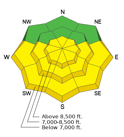
Low
Moderate
Considerable
High
Extreme
Learn how to read the forecast here
Weather and Snow
The weekend storm was a nice little refresh for the Ogden mountains with 4-8" and roughly 0.6-0.8" snow water equivalent.
Currently, skies are partly cloudy with light winds from the west northwest. Temperatures are in the upper teens to low 20s.
For today, we'll have partly cloudy skies with a chance of an afternoon shower or two. Winds will be light from the northwest. Mercifully, temperatures will slowly warm into the mid-20s up high, the mid 30s down low.
The Outlook: slowly warming temperatures and a building ridge of high pressure for the week. Friday's mountain temps are expected to soar into the upper 40s to low 50s. The models suggest another storm for the late weekend into early next week...but a lot can change between now and then.
Recent Avalanches
Ski area avalanche teams yesterday triggered new soft slab avalanches and loose snow sluffs large enough to bury a person. These slabs were generally relegated to the higher elevation bands. No reports from the backcountry.
Ad
Avalanche Problem #1
Wind Drifted Snow
Type
Location
Likelihood
Size
Description
Isolated soft slabs of wind drifted snow may still be found in the upper elevations and more likely on north to east to southerly facing aspects. Shooting cracks are dead give-aways for lingering instabilities. Continue to avoid round, pillowy deposits of wind drifted snow. Continue to have your A game on - keep an eye on each other and keep with strict travel protocols.
Avalanche Problem #2
Wet Snow
Type
Location
Likelihood
Size
Description
Wet avalanches will be increasingly possible with periods of sun and slowly warming temperatures. I don't think things will get out of hand, but don't discount the April sun to trigger some wet and dry sluffs in the steepest terrain, at a minimum. If we see more sun than expected, you'll see all the tell-tale signs and pre-cursors of wet avalanches (pinwheels, rollerballs, etc) and you'll want to avoid being on or beneath steep sun-affected terrain.
General Announcements
This information does not apply to developed ski areas or highways where avalanche control is normally done. This forecast is from the U.S.D.A. Forest Service, which is solely responsible for its content. This forecast describes general avalanche conditions and local variations always occur.