Forecast for the Ogden Area Mountains

Issued by Drew Hardesty on
Tuesday morning, February 11, 2025
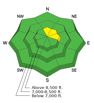
The avalanche danger is MODERATE on upper-elevation slopes for both loose snow avalanches and pockety soft slab avalanches. In very isolated northerly facing terrain, these avalanches could step down into buried weak layers of faceted snow.
Low
Moderate
Considerable
High
Extreme
Learn how to read the forecast here
Special Announcements
A very preliminary report for the avalanche fatality in the East Bowl of Silverfork from Saturday can be found HERE>
Weather and Snow
Skies are mostly cloudy-becoming-overcast ahead of a weak brush-by system that may bring an inch or two of snow. Mostly, though, it'll bring much colder temps and we'll see temps straddling 0°F by tomorrow. A stronger system arrives late Thursday through Saturday. Riding conditions are good in the sun and wind sheltered terrain.
Recent Avalanches
None.
Avalanche Problem #1
Persistent Weak Layer
Type

Location

Likelihood

Size

Description
The snowpack is structured and complex for this time of year. Long time backcountry skier Bill Brandt took some time to investigate the snowpack on an upper elevation northwest facing slope and didn't like what he saw and chose to ride a different slope. His excellent report is HERE.
General Announcements
This information does not apply to developed ski areas or highways where avalanche control is normally done. This forecast is from the U.S.D.A. Forest Service, which is solely responsible for its content. This forecast describes general avalanche conditions and local variations always occur.