Join us at our 2nd Annual Blizzard Ball

Forecast for the Ogden Area Mountains

Greg Gagne
Issued by Greg Gagne on
Friday morning, November 29, 2024
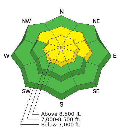
The avalanche danger is MODERATE on slopes facing northwest through north and east at the mid and upper elevations where it is possible to trigger an avalanche up to 2' deep failing on a persistent weak layer of faceted snow down near the ground. There is also a MODERATE danger on all aspects at the upper elevations for shallow wind drifts and small, wet-loose avalanches on southerly aspects.
Low
Moderate
Considerable
High
Extreme
Learn how to read the forecast here
Special Announcements
The 17th Annual Utah Snow and Avalanche Workshop (USAW) is scheduled for Saturday December 7th - Information and tickets available here.

If you trigger or see an avalanche adjacent to the road or one of the ski areas and are sure no one was caught in the avalanche, call the nearest mountain dispatch and alert them to the situation, this will allow SAR teams to stand down, preventing them from being subjected to unnecessary hazard.
Snowbasin Resort Dispatch-(801-620-1017)
Powder Mountain Dispatch- (801-745-3772 ext 3)
Quick refresher on Backcountry Emergencies and Avalanche Response HERE. You may just save a life
Weather and Snow
This morning, the skies are clear with temperatures ranging from the mid-teens to the low 20's F. Winds are from the southwest and have increased overnight, gusting into the 20's mph.
For today, skies will be sunny with temperatures rising into the mid 20's and low 30's F. Winds will be from the southwest and will gust into the upper 20's mph along exposed mid and upper-level ridgelines.
Get used to the sunshine; there are no storms through at least the next seven days.
Recent Avalanches
No reports of avalanches in the Ogden mountains. To our south in the Salt Lake mountains, three skier/boarder triggered avalanches were reported from the backcountry on Thursday:
West Monitor Bowl (Park City Ridgeline) NE aspect at 9,800' 18-24" deep / 150' wide / 600` vertical.
Scott's Bowl (Park City Ridgeline) NE aspect at 9,800' 18" deep / 100' wide / 150' vertical.
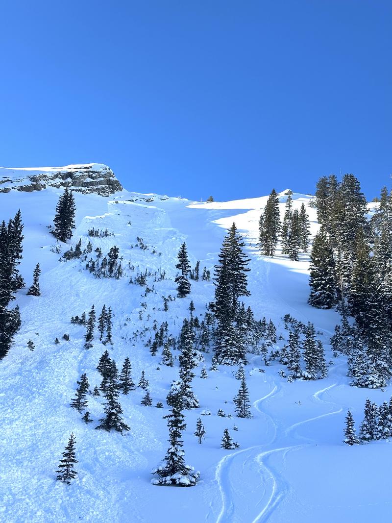
Two Dogs* (Days Fork) NE aspect at 9,600' / 18" deep / 100' wide / 450' vertical. (Photo below)
(*The Two Dogs avalanche actually involved two avalanches as the party triggered a second avalanche lower down the slope on their exit.)
Ad
Avalanche Problem #1
Persistent Weak Layer
Type
Location
Likelihood
Size
Description
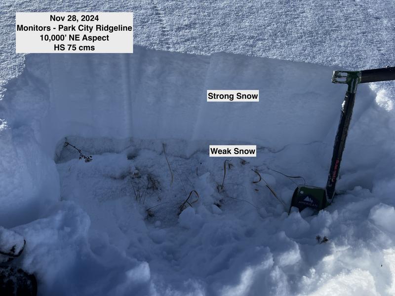
Although we received no reports of avalanches, the three human-triggered avalanches from Thursday in the Salt Lake mountains all ran on the same persistent weak layer (PWL) of weak, faceted snow that is found at the base of our 1-2.5' deep snowpack on mid and upper elevation slopes facing northwest through east. As this weak layer slowly adjusts to the weight of the storm snow from Tuesday, you may get fewer clues - such as cracking and collapsing - about this instability and tracks on a slope may give you a false sense of stability.
If you choose to venture onto slopes where this PWL exists, you will have to first dig down and look for the structure of strong (harder/firmer) snow on top of weak (softer/looser) snow (see image below). If you see this structure, it is possible you will trigger an avalanche up to 2' deep and over 100' wide.
On Wednesday, Drew was in the Powder Mountain backcountry where his pit results demonstrated this poor structure of strong snow on top of weak snow.
Avalanche Problem #2
Wind Drifted Snow
Type
Location
Likelihood
Size
Description
Watch for fresh, shallow wind drifts along exposed upper elevation ridgelines.
General Announcements
This information does not apply to developed ski areas or highways where avalanche control is normally done. This forecast is from the U.S.D.A. Forest Service, which is solely responsible for its content. This forecast describes general avalanche conditions and local variations always occur.