Join us at our 2nd Annual Blizzard Ball

Forecast for the Ogden Area Mountains

Trent Meisenheimer
Issued by Trent Meisenheimer on
Sunday morning, November 24, 2024
There is more snow in the southern half of the Ogden Area forecast region, and your primary concern is finding rocks and stumps that are barely covered.
Updates will follow as conditions warrant. This update is from 7:00 AM Sunday, November 24, 2024.
Low
Moderate
Considerable
High
Extreme
Learn how to read the forecast here
Special Announcements
The 17th Annual Utah Snow and Avalanche Workshop (USAW) is scheduled for Saturday December 7th - Information and tickets available here.
Weather and Snow
It's snowing!!! Overnight totals are 2-6 inches of new snow with 0.17-0.40 inches of water. Current mountain temperatures range from 20-27 °F. The wind has finally calmed down and is now blowing from the west-northwest across the upper-elevation terrain at speeds of 10-15 mph with gusts into the 20s.
Today, we expect it to continue snowing through the morning hours, with the heaviest snowfall around 8:00 AM. The National Weather Service calls for 4-8 inches of snow with 0.2-0.50 inches of water throughout the day. Temperatures will climb into the upper 20s °F. The wind will continue blowing from the west-northwest and should remain relatively calm with 5-15 mph speeds across the upper elevations. Snowfall will wind down this afternoon, followed by partly cloudy skies.
There will be a short break in the action on Monday before another more potent storm arrives overnight and lasts into Wednesday. Right now, this looks like feet of snow and inches of water.
Recent Avalanches
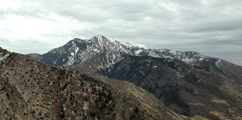
Check out all recent observations and avalanches from the Ogden Area Mountains HERE. Derek DeBruin snapped a photo before the storm for coverage (see below).
Ad
Avalanche Problem #1
Normal Caution
Type
Location
Likelihood
Size
Description
There is little snow out there to turn on and the biggest hazard will be hitting rocks and stumps. However, please remember the points below if you are heading out today.
  • New Snow - The new snow may not bond well to the different crusts and weak faceted snow in our shallow snowpack. There will be a potential for sluffing and even shallow soft slabs of storm snow, especially during any period of higher precipitation
  • Wind-Drifted Snow - Blowing winds will cause snow to drift at the upper elevations. Watch for signs such as cracking in fresh wind slabs. Although these drifts should be small, you will want to avoid getting caught in one in steep, consequential terrain
General Announcements
This information does not apply to developed ski areas or highways where avalanche control is normally done. This forecast is from the U.S.D.A. Forest Service, which is solely responsible for its content. This forecast describes general avalanche conditions and local variations always occur.