Join us at our 2nd Annual Blizzard Ball

Forecast for the Ogden Area Mountains

Paige Pagnucco
Issued by Paige Pagnucco on
Wednesday morning, January 15, 2025
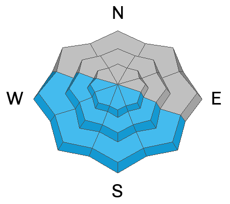
Today, there is MODERATE avalanche danger as it is still possible to trigger avalanches 1'-3' deep and up to 200' wide in thin, rocky zones or on slopes where avalanches have occurred earlier this season. Cautious route finding and conservative decision-making are essential, especially in steeper terrain with buried, persistent weak layers, primarily facing the north half of the compass at mid to upper elevations. With significant warming today, expect solar slopes to shed loose wet sluffs with potentially deep debris piles.
Low
Moderate
Considerable
High
Extreme
Learn how to read the forecast here
Special Announcements
Receive forecast region text message alerts about changing avalanche conditions, watches, and warnings. Sign up HERE.
Weather and Snow
Some high clouds this morning should dissipate by midday, and temperatures at mountain weather stations are in the teens to 20 °F. Winds are blowing from the north-northeast at 10-15 mph with 20 mph gusts. The state sits at 92% of the median snow water equivalent (SWE) for this time of year. You can still find shallow, soft snow in sheltered terrain.
It will be a beautiful day in the mountains, with light winds from the north, sunny skies, and temperatures reaching almost 32°F at 10,000'. Expect similar conditions tomorrow. The next storm rolls in on Friday, bringing VERY COLD temperatures and a chance of snow for the weekend.
Recent Avalanches
Yesterday, no backcountry avalanches were reported in the Ogden region.
Check out all observations and avalanches HERE.
Ad
Avalanche Problem #1
Persistent Weak Layer
Type
Location
Likelihood
Size
Description
The buried layer of weak, faceted snow is our main issue. Avalanches on this layer are more likely in thin, rocky terrain or where avalanches have already occurred this season. While the weak layer is gaining strength, many slopes are not yet stable. You have to hit the right spot on the right slope. Or, really, the wrong spot on the wrong slope to trigger a large avalanche. I think this problem is less pronounced in the Ogden area mountains, but I'm still avoiding this type of terrain.
Avalanche Problem #2
Wind Drifted Snow
Type
Location
Likelihood
Size
Description
The winds are becoming less of an issue and should be mild today in all but the highest, most exposed terrain. You may find a sensitive slab near the ridgelines and around exposed terrain features. Cross-loaded slopes and cornices are good indicators of wind loading. The biggest concern with wind-drifted snow avalanches is they can break down into the buried pwl, causing a much larger slide.
Avalanche Problem #3
Wet Snow
Type
Location
Likelihood
Size
Description
Due to daytime warming, wet snow avalanches may occur on solar aspects at all elevations. These avalanches could carry more snow than expected and create large debris piles. Move to a shadier aspect to find colder snow. Avoid traveling underneath steep slopes with saturated snow.
Additional Information
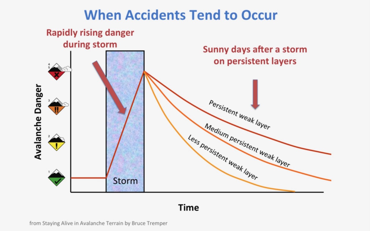
The avalanche danger scale is not linear, which means that the avalanche danger doesn't jump quickly between levels. It is a much more gradual change, and right now we are on the highest end of the MODERATE danger scale, which means that you may see travel advice that more closely matches what we would see during periods of CONSIDERABLE avalanche danger. The snowpack is solid MODERATE right now, but the human factor is always an unknown. Read more about the non-linear nature of the avalanche scale HERE.

Longtime avalanche forecaster Eric Trenbeath writes more about MODERATE danger with a buried persistent weak layer HERE.
General Announcements
This information does not apply to developed ski areas or highways where avalanche control is normally done. This forecast is from the U.S.D.A. Forest Service, which is solely responsible for its content. This forecast describes general avalanche conditions and local variations always occur.