This weekend will see the end of regular avalanche forecasts.
Road Conditions: Bare dirt down low, mud and a few inches of rutted snow on the upper end.
Grooming: Done for the season.
7:00 a.m. weather data:
24 Hour Snow 0" 72 Hour Snow 8" Base Depth at Gold Basin 54" Wind SW 15-25 Temp 16F
The story is the wind. Moderate NW winds yesterday shifted to the SW overnight and they've been on the increase ever since. Today look for mostly sunny skies and breezy SW winds in the 15-25 mph range with possible gusts in the 30's. High temps at 10,000' will be near freezing. Continued dry, breezy, and steadily warming conditions are on tap through the weekend.
Snowpack
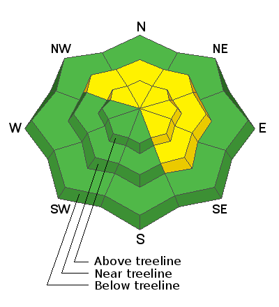
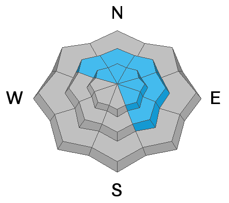
It was a bitter cold day under mostly sunny skies in the mountains yesterday with 8" of low density powder sitting on top of a hard surface. In our travels we encountered isolated, unstable wind drifts up to a foot deep on leeward slopes facing primarily north and east. Breezy SW winds today will continue to transport snow on to these aspects. We also observed evidence of loose snow avalanches that ran during the height of the storm on Tuesday. The underlying bed surface is slick and hard, and triggered avalanches may run faster and farther than you expect. This makes even small avalanches dangerous, especially in consequential terrain such as above cliffs or rock bands. Utilize slope cuts to see how the snow is behaving before jumping in to consequential terrain. If you see cracking or blocks of snow breaking off, you've found an unstable wind slab. In spite of the cold temps yesterday, the high angle of the sun dampened exposed surfaces, and many areas will be crusted over this morning.
In our travels Wednesday we observed a natural wind slab release on a NE aspect above treeline. About a foot deep and isolated to the ridge crest, it was about 50' wide but it did manage to entrain loose snow and run nearly full track. We also observed evidence of numeous, loose, dry avalanches that ran during the height of the storm on Tuesday in very steep terrain.


