Forecast for the Moab Area Mountains
Issued by Chris Benson on
Wednesday morning, March 10, 2021
Wednesday morning, March 10, 2021
The avalanche danger remains MODERATE today with two potential problems.
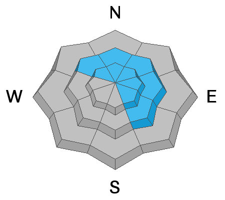
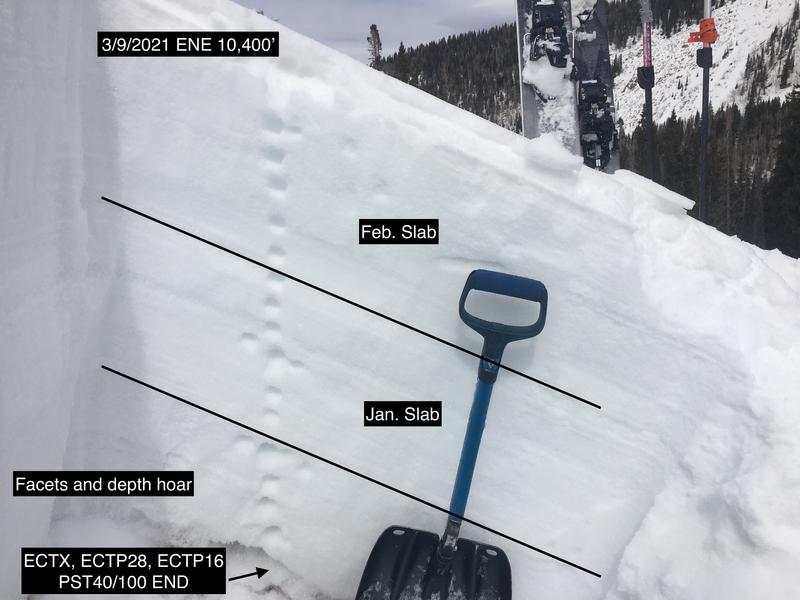
- Persistent Weak Layer Deep and dangerous human-triggered avalanches failing on a layer of sugary, faceted snow remain possible primarily on steep slopes near and above treeline that face NW-N-E-SE. This is becoming a low probability/high consequence situation. Shallow areas along slope margins and near rock outcroppings or sparse trees are potential trigger points.
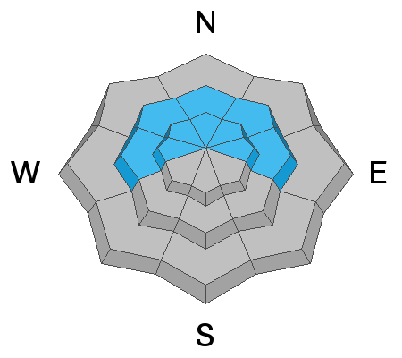
- Wind Drifts About 4" of new snow and strong southerly winds have deposited isolated, unstable wind drifts on the leeward sides of ridge crests and terrain features in upper elevation, wind exposed terrain on slopes facing W-N-E. Avoid steep wind drifted slopes.
The avalanche danger is LOW on S-SW facing slopes and all aspects below treeline.

Low
Moderate
Considerable
High
Extreme
Learn how to read the forecast here