Forecast for the Moab Area Mountains

Issued by Eric Trenbeath on
Tuesday morning, February 26, 2019
Tuesday morning, February 26, 2019
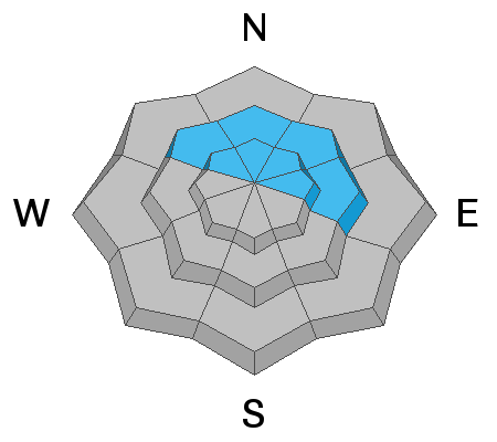
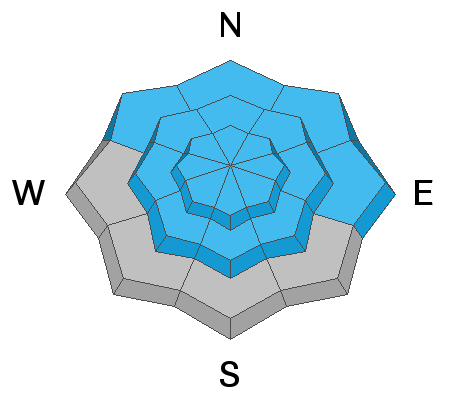
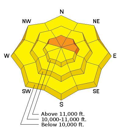
Overall, the avalanche danger is MODERATE, and human triggered avalanches involving wind drifted snow, and buried, persistent weak layers, are possible. The greatest likelihood for triggering an avalanche exists on steep, wind drifted, slopes, right around treeline and above, that face NW-NE-E. The greatest danger for avalanches involving buried persistent weak layers also exists on steep, northerly facing terrain, especially on rocky, radical, or sparsely treed slopes where the snowpack is shallow and weak. Slide paths that have already run, and then filled back in are also suspect. MODERATE danger does not imply little, or no danger, but rather that the problems are less widespread. It's important to remember that dangerous, human triggered avalanches remain a very real threat. And finally, as the day heats up, be alert to signs of wet snow instability on sun exposed slopes such as roller balls or pin wheels, and stay off of slopes that are getting wet and sloppy.
Low
Moderate
Considerable
High
Extreme
Learn how to read the forecast here