Forecast for the Moab Area Mountains

Eric Trenbeath
Issued by Eric Trenbeath on
Thursday morning, February 20, 2025
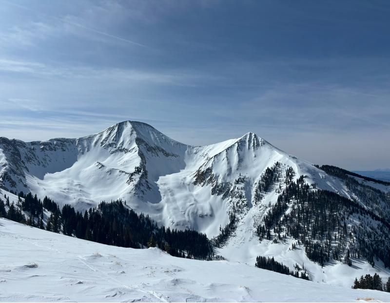
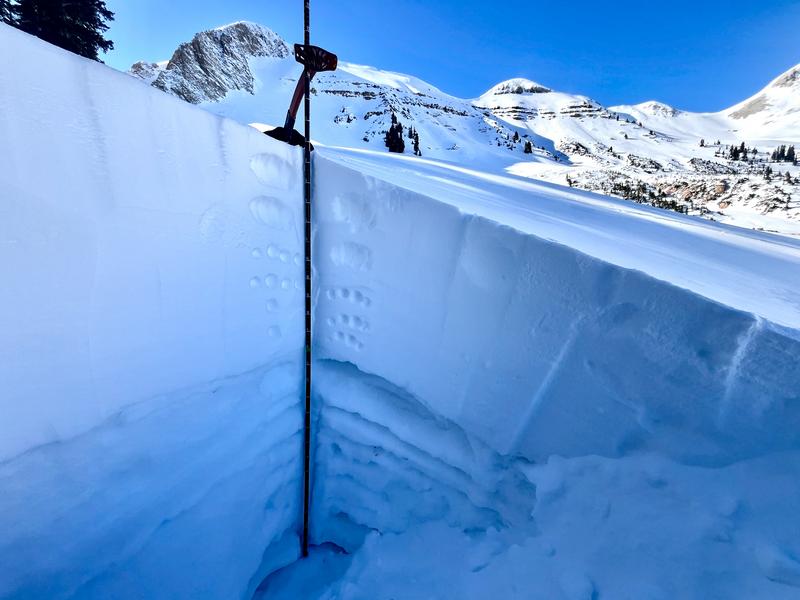
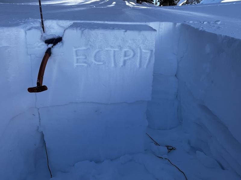
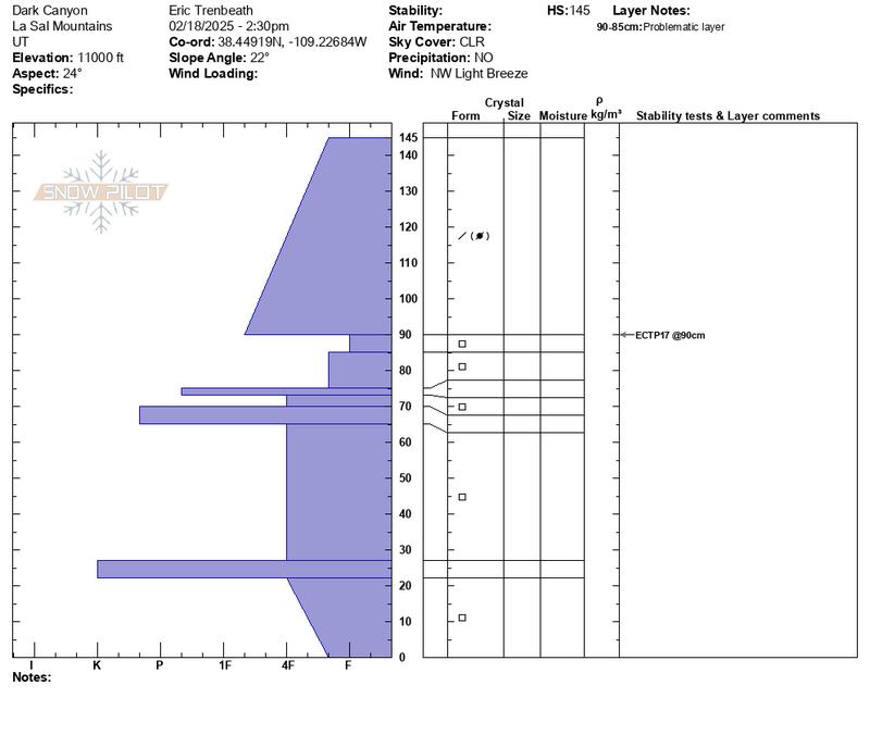
The avalanche danger remains CONSIDERABLE on steep slopes near and above treeline that face NW-N-NE-E-SE. Human-triggered avalanches failing on a buried persistent weak layer are LIKELY. Avoid slopes steeper than 30 degrees in these areas.
A MODERATE danger exists on most slopes facing the south half of the compass, and on lower elevation, northerly aspects. Human-triggered avalanches failing on a buried persistent weak layer are POSSIBLE. Continue to exercise caution in these areas, especially on slopes facing the north half of the compass.
Most low elevation, south facing terrain has LOW danger. Small avalanches on isolated terrain features are possible.
Low
Moderate
Considerable
High
Extreme
Learn how to read the forecast here
Special Announcements
Geyser Pass Road: Grand County plowed the road on Tuesday. It remains slick and snow packed. AWD and good tires recommended.
Grooming Conditions: Gavin groomed on Saturday out to Gold Basin and up to Geyser Pass.
Weather and Snow
6 A.M. Snow and Weather Data
24 Hour Snow: 0" 72 Hour Snow: 0" Season Total Snow: 80" Depth at Gold Basin: 39"
Winds on Pre-Laurel Peak: S 10 G 18 Temp: 26° F Percent of Normal (SWE): 72%
Weather
West southwest winds have been mostly light overnight with moderate speeds along ridge tops. Look for cloudy skies today with a chance for an inch or two of snow. Southwest winds will blow 10-20 mph along ridge tops and shift to northwest this afternoon. High temperatures will be in mid 20's. Look for clearing skies tomorrow with similar temperatures. Sunny skies and warmer temperatures are in store for the weekend.
General Conditions
It's been almost a week now since our last storm and with a bit of sun and wind since then, conditions are slowly deteriorating. Sam Van Wetter was up yesterday and reported variable conditions including "hot powder," and sun crusts, with some soft dry snow in sheltered areas below treeline. He also observed some localized collapsing. Read his full observation here.
The snowpack has definitely grown quieter since last weekend indicating a trend toward greater stability. But with the underlying weaknesses, I'm still not ready to trust it. Particularly on steep, northerly aspects where stability tests remain reactive. For more on that, see my observation from Dark Canyon on Wednesday.
The mountains finally look white again, and coverage is more than adequate for good travel. Sam Van Wetter photo.
Snowpack and Weather Data
Gold Basin SNOTEL site (10,000')
SNOTEL site near Geyser Pass Winter Trailhead (9600')
Wind Station on Pre-Laurel Peak (11,400')
NWS forecast for the La Sal Mountains.
Recent Avalanches
Ad
Avalanche Problem #1
Persistent Weak Layer
Type
Location
Likelihood
Size
Description
The underlying snowpack remains very weak with multiple layers of sugary, faceted snow. The primary culprit is a persistent weak layer of facets that formed in the 2 inches of snow that fell on February 11. This layer is most widespread on northerly aspects, and avalanches triggered on this weak layer will be up to 2 feet deep. They also have the very real potential to step down deeper into the snowpack causing an even more dangerous avalanche. Continue to avoid, steep slopes in these areas.
The February 11 weak layer can also be found on some south and west facing slopes although it is less widespread. I was unable to locate it in my travels on Wednesday, but Dave Garcia observed it on a popular, south facing run on Sunday, and he found it to be reactive. He discusses it in this video.
Photo illustrates weak, faceted layer underneath the most recent snow.
An extended column test produced results of ECTP17.
Additional Information
Check out the latest edition of the UAC podcast with Moab forecaster Dave Garcia where he talks about the challenges of forecasting for our remote and isolated range with limited information.
Sign up for text alerts to get the most up to date information about changing conditions, road plowing, special avalanche announcements.
Follow us on Instagram @utavy_moab
General Announcements
This forecast is from the U.S.D.A. Forest Service, which is solely responsible for its content. This forecast describes general avalanche conditions and local variations always occur.