Forecast for the Moab Area Mountains

Eric Trenbeath
Issued by Eric Trenbeath on
Thursday morning, February 20, 2020
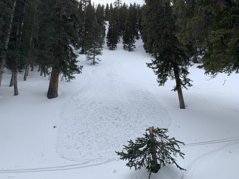
The avalanche danger is generally LOW and mostly stable snow conditions exist. Low danger doesn't mean no danger and it may still be possible to trigger an avalanche in isolated areas with very steep, rocky, extreme terrain. On steep, shady slopes, human triggered, loose snow sluffs entraining weak, faceted snow are possible. Though mostly small and manageable, one could catch you off guard and sweep you into a tree or over a cliff. Practice safe travel techniques and keep an eye toward subtle terrain features that may harbor lingering instabilities.
Low
Moderate
Considerable
High
Extreme
Learn how to read the forecast here
Special Announcements
A huge shout out to all who attended our Backcountry 101 course last weekend. It's great to see people engaged and working to further their education. And thanks again to Moab Gear Trader for their generous sponsorship of this course!
Road Conditions: The road is plowed but snow-packed and icy in places.
Grooming report: LUNA (Lower Utah Nordic Alliance) groomed on Tuesday.
Weather and Snow
24 Hour Snow 0" Weekly Snow 0" Base Depth in Gold Basin 48" Wind NE 10-20 mph Temp 2F
Weather: Another sunny day is on tap with light NE winds shifting to SW later in the day. High temps will be near 30 degrees. I can't say that I remember a February with so little snowfall but hope is appearing on the horizon. A low pressure system approaching the southern California coast looks to be positioned pretty well for us and we could get a decent shot of snow Saturday into Sunday. Check back tomorrow for more details.
Snowpack: If, for some reason, you've been following the forecast and or getting out in the mountains lately, you're no doubt aware of the deteriorating state of our snowpack. Winds have strafed and scoured the snow right down to the rocks on exposed slopes in upper elevations, and most snow surfaces are a mixture of crusts, Sastrugi, and hard wind-board. The extended period of dry weather, and cold, clear nights has resulted in fairly extensive faceting of the snowpack, particularly on shady aspects right around treeline and below. Though this soft, re-crystallized snow offers some of the best riding right now, it is extremely weak. Yesterday, Dave Garcia and Reed Kennard were able to trigger small, loose avalanches comprised entirely of weak, sugary, faceted snow. Read their observation here. These small slides are not particularly dangerous, but they are indicative of how weak the snowpack has become, and this is certainly cause for concern under a future snow load.
Wind, temperature, humidity on Pre Laurel Peak (11,700')
Storm totals at Gold Basin Study Plot (10,000').
Snotel site near Geyser Pass Trailhead (9600').
NWS weather forecast
Sluff triggered in weak, sugary, faceted snow that now makes up much of the snowpack on shady slopes below treeline. Dave Garcia photo.
Ad
Avalanche Problem #1
Normal Caution
Type
Location
Likelihood
Size
Description
Though the danger is generally LOW, there are still areas out there where you might be able to trigger an avalanche. You are most likely to find trouble in upper elevation, extreme terrain on slopes facing NW-N-SE. The distinction in arriving at LOW danger is in the size (small), likelihood (not very), and distribution (isolated), of any particular avalanche problem. Minimize your exposure by practicing safe travel techniques with an eye toward the following avalanche problems:
Wind Drifted Snow: With a wide variety of terrain features and heavy exposure to wind, there are almost always isolated wind slabs lurking about somewhere, especially at upper elevations. In isolated areas, you may encounter wind drifted snow overlying a layer of weak faceted snow. Be on the lookout for old wind slabs on the leeward sides of ridge crests and terrain features, and suspect areas that have a smooth, rounded appearance or that sound and feel hollow like a drum.
Loose snow sluffs: On steep, shady slopes, human triggered, loose snow sluffs entraining weak, faceted snow are possible. Though mostly small and manageable, one could catch you off guard and sweep you into a tree or over a cliff.
Persistent Weak Layer: Shallow snowpack areas are developing weak layers of loose, sugary, faceted snow. You are most likely to find these weak layers on rocky, or sparsely wooded northerly facing slopes where the snowpack is less than about 4' deep. Faceted snow is also developing near the surface, or underneath a variety of crusts that exist out there. Though not posing much of a threat at this time, this will become a concern with future snow loads.
General Announcements
My radio interview on KZMU about the history of backcountry skiing in the La Sals, avalanche accidents, and unique snowpack has been saved in perpetuity. You can listen to it here.
Check out the avalanche beacon training park at the Geyser Pass Trailhead and practice your rescue skills!
This forecast is from the U.S. Forest Service, which is solely responsible for its content. This forecast describes general avalanche conditions and local variations always occur.