Road Conditions: Grand County plowed the road to Geyser Pass Trailhead yesterday. The road is snow packed and dirt. AWD and good tires are recommended.
Grooming: The Geyser Pass Road above the winter trailhead closes on Dec 15. Grooming will commence after that.
Join us for the
1st Annual UAC Moab/LUNA Winter Kickoff Party on Saturday, Dec 10 at the MARC. The event will be from 7-9 PM. Get your
tickets here. The Utah Avalanche Center wants to give you free batteries for your beacons. Head on over to Moab Gear Trader to pick up your free batteries. While you are there, scan a QR code to fill out a quick survey and be entered to win some avalanche rescue gear.
Join the Utah Avalanche Center and the Division of Outdoor Recreation to celebrate the
Fourth Annual Avalanche Awareness Week, from December 4 - December 11. Click
HERE to view a full list of events throughout the state.
24 Hour Snow 0" 72 Hour Snow 14" Season Total Snow 55" Base Depth at Gold Basin 32"
Winds on Pre Laurel Peak S 20-25 G30
Temp 19F
Weather
Southerly winds ramped up over night as a weak shortwave trough began it's trek through the region. As it tracks by to the north, we'll be left with cloudy skies and breezy SW winds. Skies should clear later today as the system moves on followed by a transient ridge and dry conditions through the weekend. Shaping up over the West Coast is the next significant storm system. This should begin impacting our area late Sunday night with snow likely into Tuesday. Keep the train coming!
General Conditions
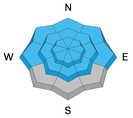
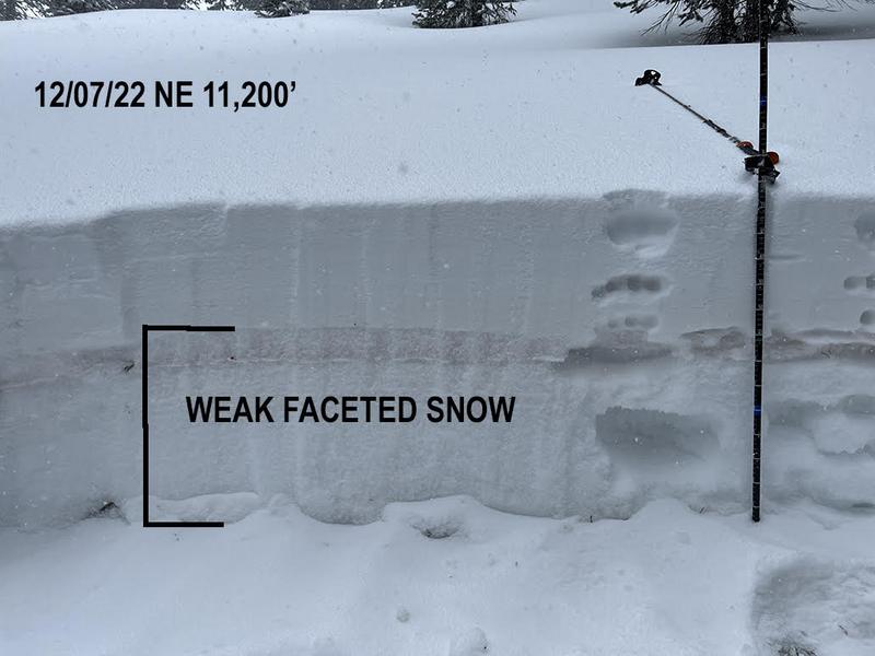
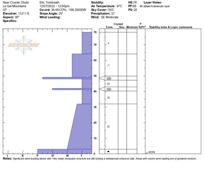
This week's storm system gave the snowpack a much needed boost and there is now enough coverage for cautious backcountry skiing and riding. The recent snow load also pushed the fragile snowpack to its breaking point. Observers in the backcountry yesterday reported widespread collapsing and whumphing and noted at least one significant natural avalanche in Gold Basin. The entire snowpack beneath the November 28 storm is loose, weak, and faceted and we now have 18" - 20" of snow sitting on top of that with considerably more in wind drifted areas. This translates to unstable conditions, with a poor snowpack structure that you can feel simply by poking your ski pole down through the snow.
I shot this video on Wednesday just as the storm was getting going.
Snowpack and Weather Data
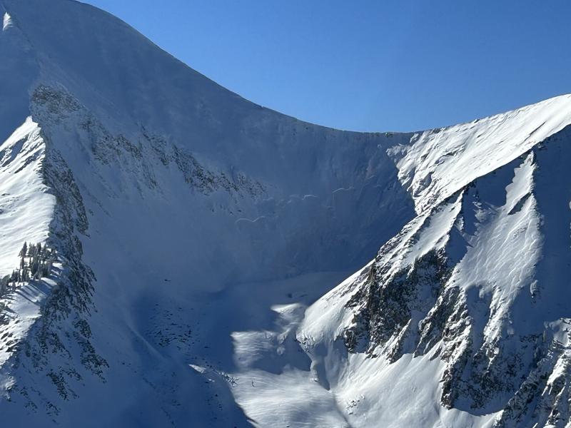
Dave Garcia and company observed this significant natural avalanche in Gold Basin yesterday that likely ran during the height of the storm on Wednesday night. It looks to be 2'-4' deep and about 200' feet wide on a northeasterly aspect. This is the current problem we are dealing with.
For a complete list of avalanches in the La Sal Range go
here.


