Forecast for the Moab Area Mountains

Eric Trenbeath
Issued by Eric Trenbeath on
Sunday morning, December 8, 2019
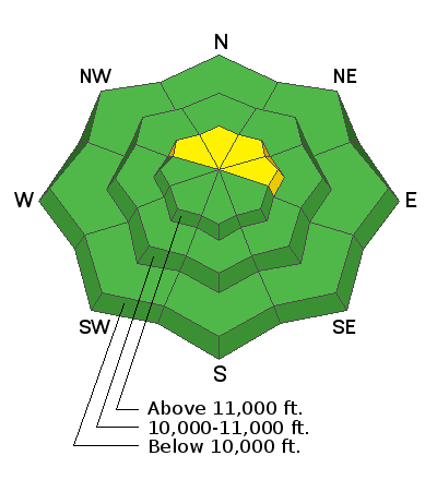
The avalanche danger is generally LOW and mostly stable snow conditions exist. Isolated areas of unstable, wind drifted snow may exist in upper elevation wind exposed terrain that faces NW-N-E. And though unlikely, it may also be possible to trigger an avalanche on a buried persistent weak layer on steep, northerly facing terrain.
Low
Moderate
Considerable
High
Extreme
Learn how to read the forecast here
Special Announcements
The road to Geyser Pass Trailhead has not been plowed since the last storm and crews plan to hold off until the next one. Lots of traffic has driven through the 4" or so that was on the road but plan on needing at least all-wheel drive with good tires to make it.
The first UAC podcast of the season " Early Season Essentials with Program Director Bo Torrey" check it out HERE.
Get one of these cool t-shirts to support the UAC and other avalanche centers across the U.S.
Weather and Snow
In spite of the wild weather we experienced in town, yesterday's storm failed to meet even my pessimistic expectations and Gold Basin is reporting a big fat 0" of new snow. Moderate WSW winds yesterday shifted to the NW by afternoon and they are currently averaging 10-15 mph. 10,000' temps are in the high teens. Today look for mostly sunny skies, increasing NW winds, and high temps in the mid 20's. A dry NW flow sets up through mid-week with the next storm on track for Thu-Fri. This system currently looks like it will favor the northern and central mountains but it's still too far out for details.
Snow conditions are deteriorating with a variety of sun and wind crusts on exposed surfaces. Soft powder can still be found in sheltered areas. See this observation from Tim Mathews who was up on Sunday.
And then check out this video from our travels on Friday.
Wind, temperature, humidity on Pre Laurel Peak (11,700')
Storm totals at Gold Basin Study Plot (10,000').
Snotel site near Geyser Pass Trailhead (9600').
NWS weather forecast.
Recent Avalanches
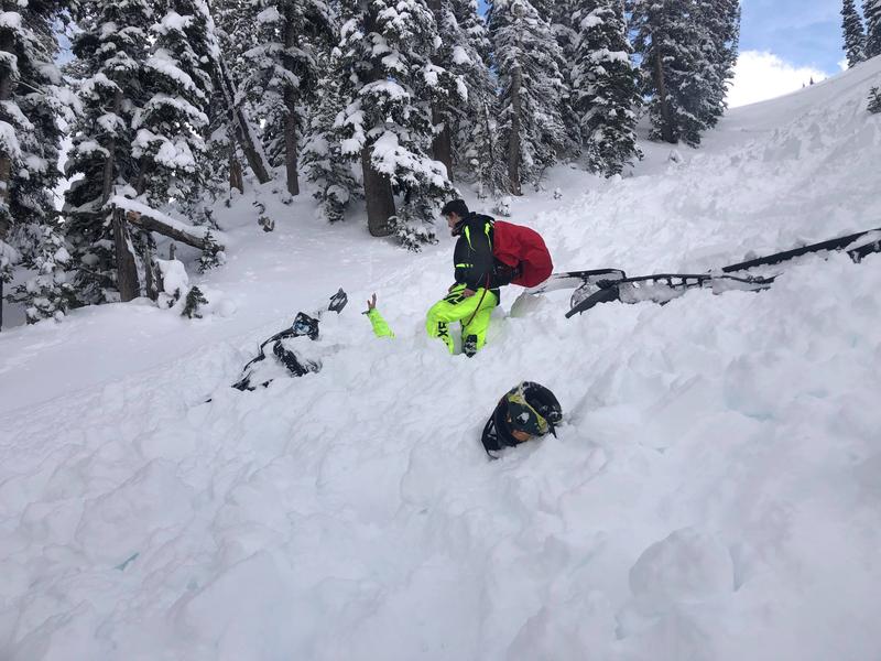
There was a close call in the Logan area mountains on Saturday where two riders were caught in an avalanche. Once was partially buried. Both ended up ok. DETAILS HERE.
The partially buried rider's had is sticking up in the photo below.
Ad
Avalanche Problem #1
Normal Caution
Type
Location
Likelihood
Size
Description
Wind Drifted Snow
The La Sals are a high, exposed, and isolated mountain range that is subject to a lot of wind. Isolated wind slabs may still exist in the high country that could be sensitive to the weight of a skier or rider. Look for hard wind slabs on the lee sides of ridge crests and terrain features in upper elevation, wind-exposed terrain. They are recognizable by their smooth, rounded appearance and my sound or feel hollow like a drum. Cracking is a sign of instability.
Persistent Weak Layer
There is a layer of moderately weak, small-grained faceted snow at the base of the snowpack. Stability tests are not producing failures on this buried weak layer but its presence is worth noting. Prudent travelers will perform their own stability tests before jumping on to any steep, northerly facing slopes. Surface hoar development has also been noted to be fairly wide-spread on shady slopes between 10,000'-11,000' over the past week. This may prove to be a future weak layer, and in isolated areas, it can be found beneath the last snowfall.
General Announcements
This forecast is from the U.S. Forest Service, which is solely responsible for its content. This forecast describes general avalanche conditions and local variations always occur.