Forecast for the Moab Area Mountains

Issued by Eric Trenbeath on
Friday morning, December 20, 2019
Friday morning, December 20, 2019
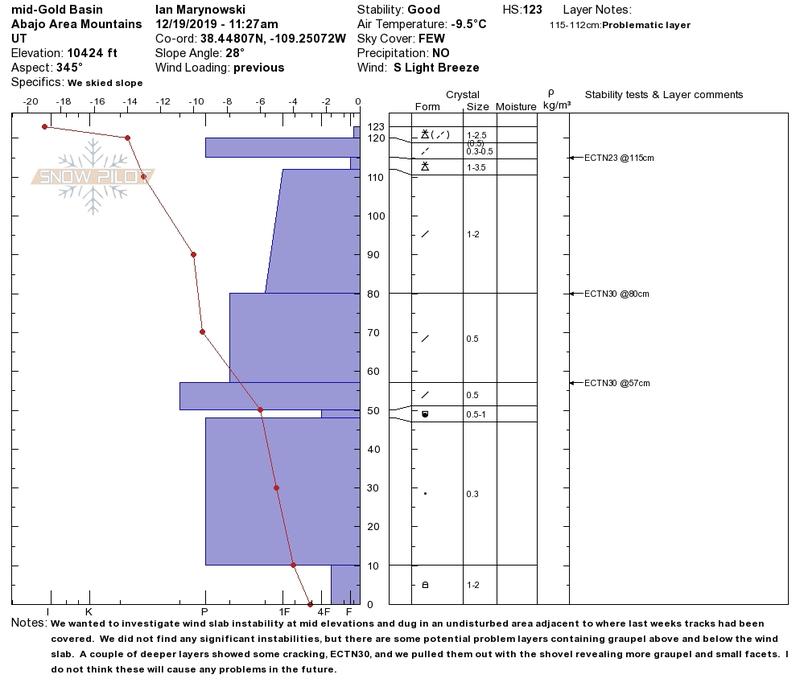
Blowing and drifting snow have created an isolated or MODERATE avalanche danger in steep upper elevation terrain. Look for fresh drifts, and older, harder wind slabs on the lee sides of ridge crests and terrain features such as sub-ridges or gully walls. Wind slabs may feel hollow underfoot, and cracking in the snow surface is a sign of instability. Most other terrain has LOW danger. We're also starting to see some developing layers of weak, sugary snow in the snowpack. Though not currently posing much of a problem, this is something we'll want to keep an eye on for the future.

Low
Moderate
Considerable
High
Extreme
Learn how to read the forecast here