Grand County Search and Rescue will be conducting winter training at the Geyser Pass Trailhead today.
Check out the new free online
avalanche course series developed by the Utah Avalanche Center. This is a great way to refresh your skills or prepare you for a Backcountry 101 or Level 1 class.
High clouds remain over the area, and SW winds have been on the increase overnight averaging 20 mph with gusts to 30 along ridge tops. It's a warm 30 degrees at the Geyser Pass Trailhead. Today look for partly cloudy skies, decreasing winds, with temperatures climbing into the mid 30's. High pressure builds for the weekend with nothing on the horizon.
Wednesday's wind event put the final hurt on exposed snow surfaces and you'll have to work hard to find soft snow in sheltered locations. Low snow conditions still prevail as well with rocks and deadfall lurking just beneath the surface so be careful out there. Base depth in Gold Basin is 30".
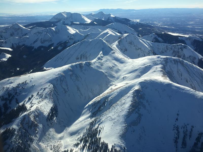
Chris Benson was out flying around on Wednesday and sent in this aerial
observation. Thanks Chris!
A view of the North Group looking south. Chris Benson photo.
New snow totals in Gold Basin (10,000')
Snow totals at the Geyser Pass Trailhead (9600')
Wind, temperature, and humidity on Pre Laurel Peak (11,700')
National Weather Service point forecast.
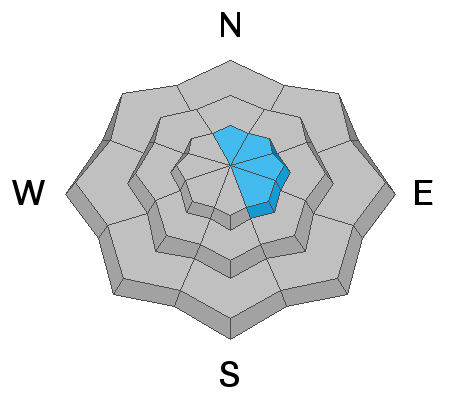
In my travels Thursday I observed a few natural avalanches from the previous day's WNW wind event. Initiating from wind drifted snow, they appeared to have broken down into old weak layers with fractures 2'-3' deep, and up to 50' wide. These all occurred on E-NE facing slopes in the highest elevations.