Forecast for the Moab Area Mountains

Eric Trenbeath
Issued by Eric Trenbeath on
Friday morning, December 13, 2019
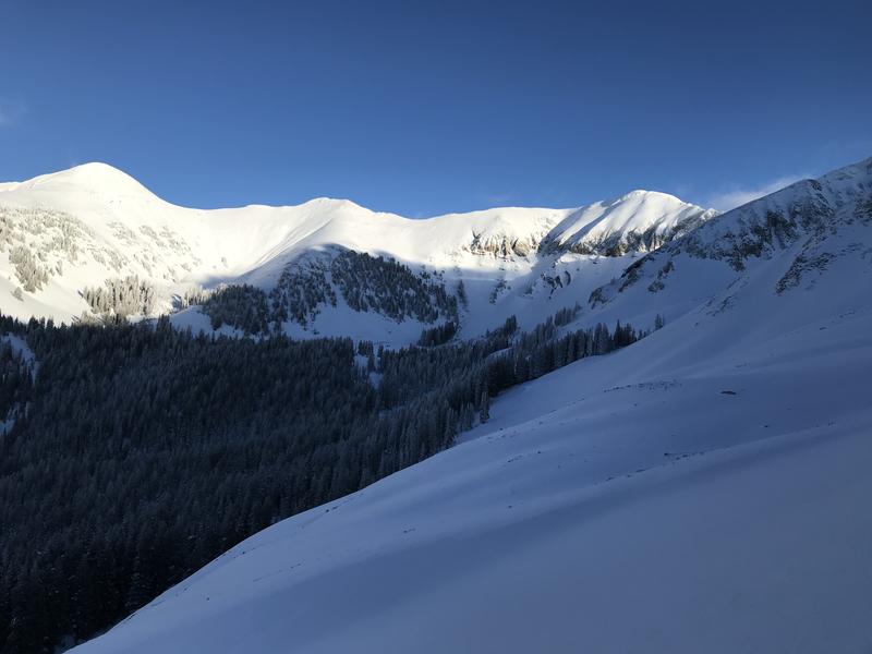
Look for a rise in avalanche danger over the weekend from blowing and drifting and snow. The avalanche danger is generally LOW this morning and mostly stable snow conditions exist. Watch for an increase in danger as a long-duration storm system spreads into our area later today. New snow amounts and wind will dictate the rise in danger, and we could start to see sensitive wind drifts and a MODERATE avalanche danger developing by tomorrow. Look for fresh drifts to form on the lee sides of ridge crests and terrain features in upper elevation, wind exposed terrain. Be alert to signs of instability such as cracking in the snow surface. It may also be possible to trigger an avalanche on a buried persistent weak layer on steep, rocky, northerly facing terrain.
Low
Moderate
Considerable
High
Extreme
Learn how to read the forecast here
Special Announcements
The avalanche beacon tester is up and running at the Geyser Pass trailhead! Walk or ride past the sign on your way up - a red X means your beacon is off or not functioning, a green O means you're good to go! Thanks to UAC volunteer and supporter Kristi Jensen from Coyote Shuttle for helping me get it set up!
Road Conditions: The road is snow packed and slick but passable to all-wheel drive vehicles with good tires.
Grooming update: Matt rolled and packed into Gold Basin on Sunday. Conditions are good for classic cross country but a bit rugged for skate skiing. I'll be picking up the other machine next week and we'll be able to start running the Ginzu groomer.
Weather and Snow
A few clouds have gathered over the mountains and NW winds are on the increase averaging 20-25 mph along ridge tops. Mountain temps are in the high teens to low 20's. A long-duration storm event has begun to affect the region with most of the energy currently focused on the northern and central mountains. It looks like we will largely be left out of the party but we should see some accumulating snow Sat night into Sun with 3"-5" likely. Today look for increasing clouds and NW winds with a chance of snow later in the day. High temps will be in the upper 20's. Winds will shift to the SW tonight and snow showers are likely with 1"-3" possible. Snow showers and blustery westerly winds are on tap for Saturday with another 1"-3" possible during the day.
Coverage ranges from 2'-4' deep above 10,000' and the base is mostly supportable. Snow conditions remain decent in sheltered areas while sun and wind crusts have formed on exposed slopes.
Colin Vogel has been out getting after it the past couple of days. See his reports on the Moab observation page.
Looking good for this time of year but it's time for more snow! Brian Hays photo.
Wind, temperature, humidity on Pre Laurel Peak (11,700')
Storm totals at Gold Basin Study Plot (10,000').
Snotel site near Geyser Pass Trailhead (9600').
NWS weather forecast.
Ad
Avalanche Problem #1
Normal Caution
Type
Location
Likelihood
Size
Description
Mostly stable snow conditions exist, but low danger doesn't mean no danger, and it's always important to maintain avalanche awareness in the mountains. Here are a couple of problems to remain aware of:
Wind Drifted Snow
Look for fresh deposits of wind drifted snow to begin forming over the next several days. You are most likely to find them on the lee sides of ridge crests and terrain features in upper elevation, wind-exposed terrain. They are recognizable by their smooth, rounded appearance and my sound or feel hollow like a drum. Cracking is a sign of instability.
Persistent Weak Layer
There is a layer of moderately weak, small-grained faceted snow at the base of the snowpack. Stability tests are not producing failures on this buried weak layer but its presence is worth noting. Prudent travelers will perform their own stability tests before jumping on to any steep, northerly facing slopes. Areas of rocky, more radical terrain with shallower snow are the most suspect.
Continue to carry appropriate rescue gear: beacon, probe, shovel and practice safe travel techniques by only putting one person on a slope at a time.
General Announcements
The first UAC podcast of the season " Early Season Essentials with Program Director Bo Torrey" check it out HERE.
Get one of these cool t-shirts to support the UAC and other avalanche centers across the U.S.
This forecast is from the U.S. Forest Service, which is solely responsible for its content. This forecast describes general avalanche conditions and local variations always occur.