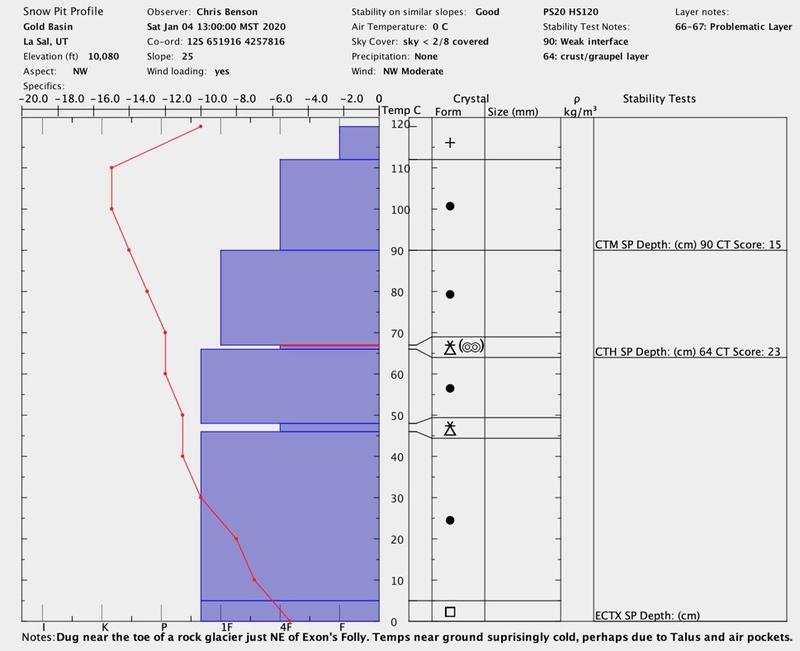
Forecast for the Moab Area Mountains

Eric Trenbeath
Issued by Eric Trenbeath on
Thursday morning, January 9, 2020
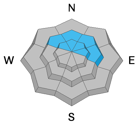
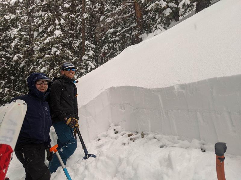
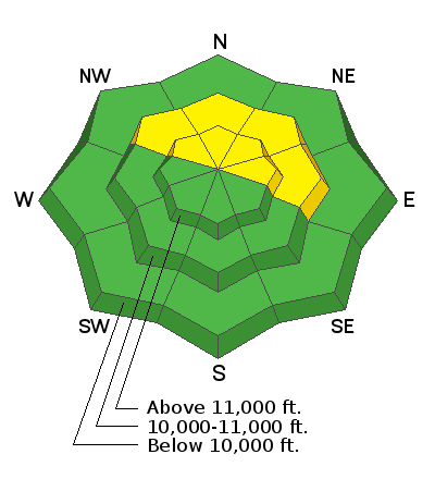
Though the odds of triggering an avalanche are decreasing, the danger remains MODERATE. Human triggered avalanches are possible on steep, wind drifted slopes primarily at upper elevations on slopes facing NW-N-E. A triggered wind slab also has the potential to step down into a buried, persistent weak layer causing a deeper and more dangerous avalanche. You are most likely to encounter a persistent weak layer on steep, shady, northerly facing slopes. Most low elevation and south-facing terrain have LOW danger.
Low
Moderate
Considerable
High
Extreme
Learn how to read the forecast here
Special Announcements
The avalanche beacon training park is up and running at the Geyser Pass Trailhead so get up there and practice! Thanks to UAC volunteers Armin Howell, Steve Evers, and Chris Benson for helping me get it set up!
Road Conditions: The road is plowed but snow-packed with occasional ice. All-wheel drive with good tires recommended.
Grooming update: Matt groomed Gold Basin through Geyser Pass yesterday.
Weather and Snow
24 Hour Snow 0" Weekly Snow 0" Base Depth in Gold Basin 40" Wind SW10-15 mph Temp 10F
The deck of stratus clouds remains but relief may be in sight! An upper-level trough on a SW flow will dive across the Great Basin and into the 4 Corners region later this afternoon. Though light on snow, this system may weaken and break the stagnant inversion that has kept the valley under low clouds for over a week. Today look for mostly skies with scattered showers developing later in the day. 1"-3" are possible by tomorrow. SW winds will average 15-20 mph along ridge tops and high temps will be in the low 20's. A dry northwesterly flow follows on Friday. Long term looks active and unsettled though it doesn't look like a lot of snow for us at this time. Let's hope that changes! At the very least, maybe we can say goodbye to the inversion!
Snow conditions have taken a hit from strong winds over the past week. Cross country or skate skiing on fresh corduroy may be the best game in town right now!
Matt Hebberd photo
Wind, temperature, humidity on Pre Laurel Peak (11,700')
Storm totals at Gold Basin Study Plot (10,000').
Snotel site near Geyser Pass Trailhead (9600').
NWS weather forecast.
Ad
Avalanche Problem #1
Wind Drifted Snow
Type
Location
Likelihood
Size
Description
Wind slabs that have developed over the course of the past week are becoming harder to trigger but it still may be possible. Strong, ridgetop winds have blown all over the compass resulting in blowing, drifting, and scouring of snow on all aspects at upper elevations. Continue to avoid steep slopes that look to be wind-loaded, or that have a smooth, rounded appearance. Cracking or "whumphing" is a sign of instability. A triggered wind slab also has the potential to step down into a buried, persistent weak layer causing a deeper and more dangerous avalanche.
Avalanche Problem #2
Persistent Weak Layer
Type
Location
Likelihood
Size
Description
The likelihood of triggering an avalanche on a buried persistent weak layer is also decreasing but areas with poor snowpack structure continue to be observed. Prudent backcountry travelers will perform their own stability analyses before jumping on to steep terrain. You are most likely to trigger an avalanche on a buried persistent weak layer on north-facing slopes that are wind-loaded, or in areas with rocky, radical terrain that have a shallow snowpack.
The photo below, taken by Travis Nauman has been up for a while, but the clearly visible persistent weak layer is still present in the snowpack, and is likely the interface with the Christmas Eve storm.
And this snow pit profile submitted by Chris Benson also illustrates the weak layers we need to keep our eyes on.
General Announcements
This forecast is from the U.S. Forest Service, which is solely responsible for its content. This forecast describes general avalanche conditions and local variations always occur.